The plan was to go to Oregon to visit our son/daughter-in-law and "do a little hiking" with them ... My wife and I gave a little effort to getting into hiking shape (after all, I had hiked a section of the AT in June), but because of work and other things (general laziness) we didn't really get in very good backpacking shape. So, when we got to Portland, our son suggested either Cloud Cap or Paradise Park on Mt. Hood. Cloud Cap was a much easier hike, but doesn't have a water source nearby, and Paradise Park is described as "difficult" in the trail guides. Hm-mm-mm ... what to do?

Well, because of years of hiking in the Sipsey Wilderness and throughout the southeast where there is usually a water source nearby, I have grown to hate hauling water and generally choose places with a water source nearby. Therefore, Paradise Park on the PCT/Timberline Trail was the last minute choice. I had shipped tent, stove, and other equipment out there earlier and planned to get food/supplies when we got there.
 |
| Mt Jefferson from Timberline Lodge |
After the son/d-in-law got off work on Monday, we headed up to the famous Timberline Lodge on the south side of Mt. Hood. The Lodge, built by the WPA in the 30s, is a memorable zero day stop on the PCT for thru hikers. The rooms are comfortable and the four of us checked into a room with four bunk beds and a shower on the hall ... much like we would had we been thru-hikers. After dumping our gear in our room, we headed up to the Ram's Head bar for supper and a brew. We all decided to shower that night so we'd be ready to head out on the trail early the next morning. Jeff and Amy showered and went out to see the stars while my wife and I -- who live in the Central TZ -- went to sleep. I never heard my son/d-in-law come in.

 Tuesday morning we dressed and went to the dining room for breakfast at 7:00. After visiting the porcelain for the last time for a few days, we put a few things in the car and headed north around the west side of Mt Hood on the PCT/Timberline. The first half mile or so of the trail crosses several of the ski slopes of Timberline, then gets serious when you get to the trail register. Although the trail goes through tall timbers, because Mt. Hood is a stratovolcano, the environment is not unlike New Mexico and parts of Arizona with sandy, arid soil and Douglas fir forests.
 |
| Sunset from Timberline Lodge |
The Timberline Trail to Paradise Park (our destination) is only about 6.5 miles, but because of a large volcanic river canyon loses and regains about 1200 feet of elevation between the trailhead and Split Rock it is rated as "difficult." The designation "difficult" means to me that my feet will hurt and I'll be puffing and panting most of the way. Most of the elevation gains and losses would be in the three-mile area of Zig Zag Canyon.
 |
| Early morning view of Mt Hood |
We crossed several small gullies including "Little Zig Zag" and got to the edge of the real Zig Zag to look down at where we had to go. The Zig Zag River in the bottom of the canyon didn't look so formidable, but we were up on the edge of the canyon about 600 feet above it. We sat on the edge of the canyon and ate a power bar and drank energy drinks to get ready for the descent and ascent of the canyon. My son pointed out the trail far on the other side almost three miles away and said that if I lived I would be hiking on that trail in a couple of hours. Then we began our descent. Surprisingly, though the view from the top of the canyon was a sharp V with steep sandy and rocky sides, the trail down slabbed the side of the valley through lush moss covered fir trees. I'm not sure what kind of moss, but it reminded me somewhat of Spanish Moss on the oak trees in the South. This moss, though, was green instead of grey and covered the trunks of the trees as well as hung from the limbs.
 |
| Trekking pole adjustment |

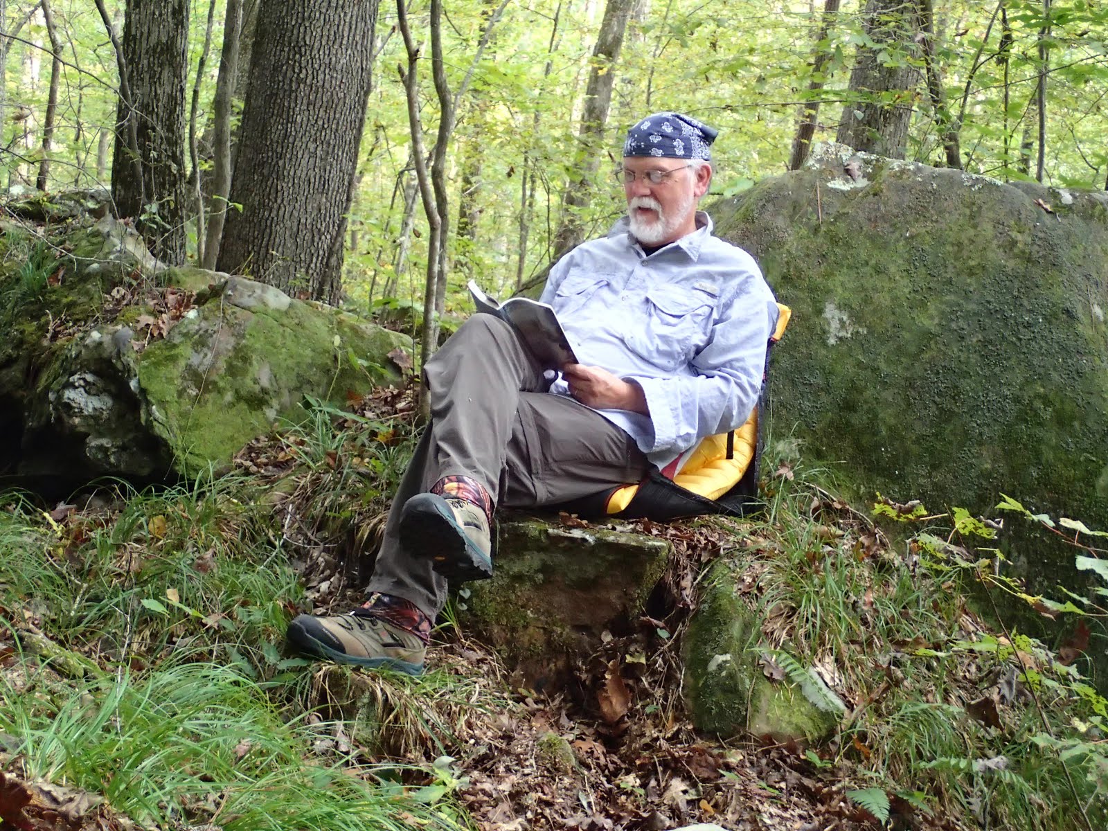
Hiking down to the river bottom was continuous and hard on old knees, but was a fairly smooth trail and not so steep that it was difficult. I commented that parts of the AT--like coming down off of the north side of Blood Mountain--was much more difficult to hike and required the use of trekking poles or a hiking stick for balance because of the very uneven, rocky trail. It was obvious that trail crews maintain this well-used trail because of the drainage cuts at intervals to keep the steep landscape from washing out after the snows melt. Coming back up the south side of Zig Zag Canyon when we were heading out, we encountered a volunteer trail crew working on a particularly wet section of the trail. They were building some drain trenches across the trail that could be stepped across rather than a 10 yd section of the trail being mud that had to be tromped through. They were working hard and the trail was a mess when we passed by, but, when finished, would repair the trail section similar to the many other step-across trenches carrying water across the trail.
 |
| Jeff and Amy |
 There were small water sources all along the trail which would be sufficient for thirsty hikers. I guess I was surprised at this, since the area as a whole seemed dusty and dry; but, of course, I'm not that familiar with the volcanic mountain areas in the northwest, so I just didn't know what to expect.
At the river, which was only about 10 ft wide, there were enough rocks for those of us with longer legs to jump across without having to take off our boots, but for those with shorter legs it meant getting shoes/boots wet or taking off boots/shoes and wading across. My son hikes in trail shoes, so he waded across with my wife who had taken off her boots and put on Crocs to get across. It was an opportunity to sit down for a while and eat a snack and drink some much-needed energy drink before the hike up the northern side of the canyon. Zig Zag Canyon is what makes this hike "difficult" in the trail descriptions rather than the "moderate" rating it might get if one didn't have to go down into and up and out of the canyon.
There were small water sources all along the trail which would be sufficient for thirsty hikers. I guess I was surprised at this, since the area as a whole seemed dusty and dry; but, of course, I'm not that familiar with the volcanic mountain areas in the northwest, so I just didn't know what to expect.
At the river, which was only about 10 ft wide, there were enough rocks for those of us with longer legs to jump across without having to take off our boots, but for those with shorter legs it meant getting shoes/boots wet or taking off boots/shoes and wading across. My son hikes in trail shoes, so he waded across with my wife who had taken off her boots and put on Crocs to get across. It was an opportunity to sit down for a while and eat a snack and drink some much-needed energy drink before the hike up the northern side of the canyon. Zig Zag Canyon is what makes this hike "difficult" in the trail descriptions rather than the "moderate" rating it might get if one didn't have to go down into and up and out of the canyon.
 |
| The upper end of Zig Zag Canyon and Mt Hood |
 |
| Headwaters of the Zig Zag River |
Hiking up the north side we came to the fork of the Timberline Trail and the PCT where the Timberline loops east up toward Mt. Hood and the PCT stays west of the summit. The trails are basically parallel after they separate and come back together at the north end of Paradise Park forming a loop that many hike in one day. After getting to the top of the canyon on the Timberline Trail, we continued north toward Paradise Park and our home for two nights. Soon we came to the site of an old shelter of which nothing was left but part of the foundation. I think it was a shelter built by the WPA or CCC in the 40s, but had gone away after many winters on the side of Mt. Hood. I think the shelter signaled the entrance in to Paradise Park ...
 Our goal was to camp under the lone tree next to Split Rock, so my son/daughter-in-law hiked on ahead to make sure no one else had already claimed that spot. Split Rock is an icon in Paradise Park and we wanted to camp there at least one of our two nights. Shortly after passing the shelter foundation, we came to a small stream rushing down the mountainside. There was a wonderful camp site on a little bluff overlooking the stream. It may have been one of the most beautiful campsites I've ever encountered. There wasn't an open expanse view to the west, but the eastern view looked up the creek canyon right at the peak of Mr. Hood. My son later said the first time he passed that campsite he knew I would love it and want to stay there. We crossed the stream and passed on by that campsite because our goal was to get out on the open mountainside where the stars and sky are endless. I told my son later that if I ever came back to Paradise Park I wanted to camp in that campsite.
 Not too long after passing the paradise campsite, the trail went up gradually and we began to get to the edge of the treelike at about 6,000 ft. Once the area opened up to the mountainside, the plants changed their looks. Gone were the fields of wildflowers and beargrass except along the occasional small stream flowing down from some melting snow/ice. The plants were in abundance along the streams, but away from the streams were fields of volcanic sand, boulders, and rocks. There were occasional trees and tree skeletons, but nothing to give much shade in the bright sunshine. The area was filled with some kind of bush covered with red berries and the birds were loving the berries. I saw what appeared to be deer prints in the sand and an occasional pile of scat loaded with berries. Some of the scat looked like bear scat, but I'm not knowledgeable enough to know for sure. I do know that the deer prints were ubiquitous and some fresh. They must come up out of the trees to eat and drink early in the morning. We didn't ever see the actual animals, but we saw evidence of them.
 |
| Our first view of Split Rock |
 My son/d-in-law met us back down the trail and said that no one had yet claimed the Split Rock campsite, so we headed a bit uphill toward that monument.
 |
| Mt Hood at sunset |


 After that side trail and a couple of other stops we pulled into the Indian Springs (abandoned) campground. I guess the FS got tired of hauling the trash out, so they stopped keeping it up. There were about 4 or 5 picnic table and Jeff and I found one down by itself and started setting up our stuff. The campsite was not crowded by the other campsites, but it was in view of the privy.

 Finally, I said, "Jeff, I'm staying right here."


 After that side trail and a couple of other stops we pulled into the Indian Springs (abandoned) campground. I guess the FS got tired of hauling the trash out, so they stopped keeping it up. There were about 4 or 5 picnic table and Jeff and I found one down by itself and started setting up our stuff. The campsite was not crowded by the other campsites, but it was in view of the privy.


 Finally, I said, "Jeff, I'm staying right here."


.jpg)