Tuesday, June 2, 2015

Walkabout 2015 - Appalachian Trail Iron Mountain Gap to 19E May 2015

Out a window at the parking
lot of the hostel
I had scheduled my annual walkabout at the end of May hoping the rhododendrons would be blooming on the AT, but they weren't ... I guess I picked an altitude too high for the rhodos before June. I swear I thought they would be in bloom this time of year. Ah, well ... as I arrived at the Mountain Harbour Hostel between Roan Mountain, Tenn, and Elk Park, NC, though, I immediately noticed a hikers' shoes and socks in full "bloom" on the deck of the hostel. Stinky feet is not limited to hikers, but is almost always present when hikers are near.
The start of the section hike
     And let me give a plug for the Mountain Harbour Hostel on Hwy 19E near mile 393.8 on the AT. The hostel has been packed every night for the past six weeks and so has the B&B. MH has tent sites also and shuttles section hikers like me all over that region. But the feature I want to make sure you understand is the owner's, Mary's, breakfast ... every hiker I encountered on the trail either knew first hand or had heard that the breakfast at MH was the best on the AT. Mary certainly has my vote. For $12 you can forget how badly your feet hurt or how miserable you've been carrying rain-ladened gear. The showers at the hostel are wonderful, but the breakfast is orgasmic!
Guthook's Guide
     Thankfully, I had made a reservation several weeks in advance for the Saturday night of the Memorial Day weekend. I hadn't paid close attention to the holiday weekend, and, had I waited until driving up to MH, I wouldn't have had a place to stay that night. Anyway, I had made a reservation for a bed in the hostel, breakfast the next morning, and a reservation for a shuttle to Iron Mountain Gap at 363.1 on the AT.
My tarp near the
Clyde Smith Shelter
     Sunday morning after breakfast, David shuttled me to Iron Mountain Gap to begin my section hike. My pack weighed in at 32 lbs, including food. Not knowing how well I could carry my load on that section of the trail, I planned only six miles the first day planning to stay in/near the Clyde Smith Shelter. I honestly don't remember much about the trail on that first day, except that it wasn't particularly difficult. When I got to the shelter a hiker's dog began barking and barking at me ... the owner, Country Gold, introduced himself and apologized for his dog. There was a big camping area around the shelter and I decided to pitch my Z-Packs Hexamid Twin instead of staying in the shelter. As other hikers began to arrive, Sunshine, the dog, barked at everyone until Country Gold introduced himself. At some point, I began to discern that Country Gold was hearing impaired and his service dog was trained to bark to alert him to something/one coming near. After Country Gold introduced himself, Sunshine wouldn't bark at that person anymore.
     The weather was wonderful and I had a good setup, so the night was very pleasant and the meal preparation went well. 
My little pill bags
Looking off Little Rock Knob vista
     I had heart surgery a couple of years ago and have to take prescription meds every morning and every evening. Last year on my walkabout I stuffed all my meds in a big container and each morning and night had to pour them out on a bandana and sort through the pile until I found the meds I was supposed to take. Sometimes that's not easy when the weather conditions aren't great. This year I purchased some small 2X2 ziptop bags and wrote "AM" and "PM" on them to make the daily taking of meds much easier--sixteen little baggies for my walkabout. Worked perfectly and I didn't drop any meds or forget to take them ... 
Guthook's app for
Cloudland Park
     Monday morning I awoke, ate some oatmeal, and got on the trail about 9:30 ... which I thought was good, except when I went by the shelter and through the campsite, I was the last one to leave. Oh, well ... I slept pretty well and felt good for my second day. I wasn't looking forward to that day's trail, because I had to lose about 500 ft of elevation down to Hughes Gap and then began two huge climbs. The climb up and over to Ash Gap was over 1200 ft gain, and then another 900 ft gain up to the Roan Mountain/Cloudland Park area. For me, it was an all-day hike. My plan was to stay at the Roan High Knob shelter, but several SOBOs who passed me said that they had spent a very cold and windy night at the shelter; plus everyone was saying that a big storm was blowing in for the night. I thought that I would see if I could find a place in the trees before the park area to pitch a tent and hunker down for the night.
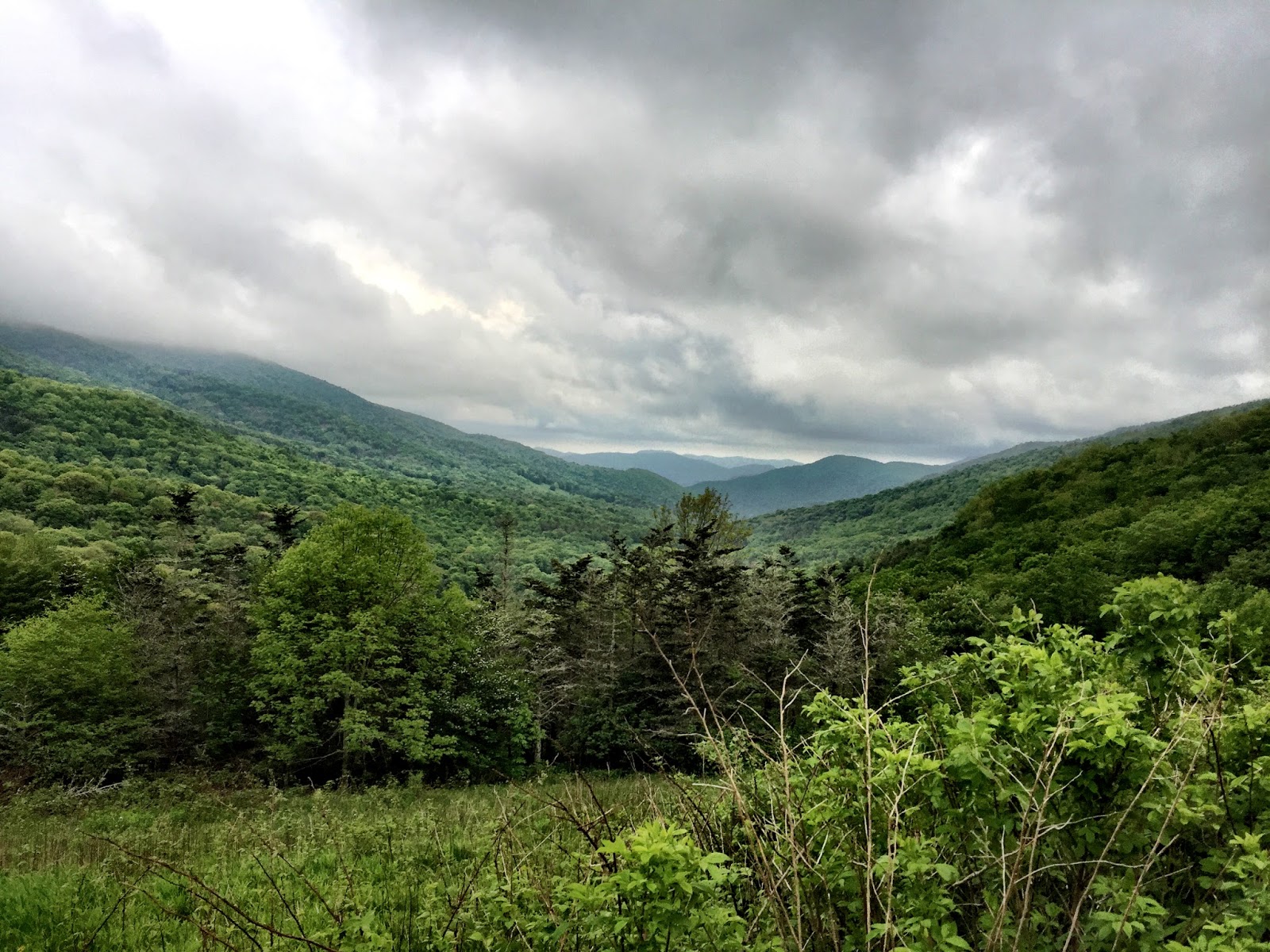
     The trail down to Hughes Gap was fairly uneventful. I stopped to look out over the valley from Little Rock Knob and got a passing hiker to take my pic. The view was nice, but not spectacular ... I've hiked too much in the west, I guess ... 
A lonesome rhodo near the
Cloudland Hotel site
     I crossed the road at Hughes Gap and started up the mountain ... and it was unrelentingly upward. Interestingly, AWOL's guide doesn't have anything listed between Hughes Gap and Ash Gap except a water supply back by Hughes Gap. It's one of those trails where you don't have the opportunity to look around much; you're just looking at where your feet will land on the trail. There are lots of "steps" typical on the GA/TN/NC AT ... big boulders that trail crews have pulled about to give the hiker something to step on to get to the next level. It's not fun, and it's not easy for old legs. 
Typical AT trail
     At Ash Gap's big campsite I was greeted with Sunshine's barks letting Country Gold know that I was coming into the camping area. CG introduced himself again, we shook hands, and Sunshine quit barking. I took my pack off and asked about the water source. CG told me that there was a water source down--way, way down--the hill, so I grabbed my water bottles and headed down ... and, dang! He wasn't exaggerating ... from way down by the spring I heard Sunshine bark a couple of sets, so I knew others had pulled into the campsite. Soon a guy and a girl came down to get water just as I was finishing. Of course, we talked about the hike down to the spring and the impending hike back up to the campsite.
Typical AT stream crossing
     Getting back to Ash Gap, CG told me he was done for the day and was climbing in his tent for a nap. We talked for a while and he said that he had been on the city streets for a while, then someone turned him on to the mountains and he'd been on the trail ever since. Sunshine started barking and another couple came in to take a break and get some water. This couple--a young twenty something--I would see several times throughout my hike ... although I never did get their names. The guy had Guthook's app on his phone and  he showed me the elevation from Ash Gap into the Cloudland Park area ... a pretty steep looking up. I said I would see them before Cloudland when they passed me, and I packed up and headed uphill. Phodo and two followers--one with a lute and one with two interlocking hulahoop-looking things--passed me somewhere after Ash Gap. He was shouting some sort of rant when he went by, reminding me of Del Gue's rant when he parted ways with Jeremiah Johnson. The two followers were pulled off the trail playing on a lute and singing while Del Gue/Phodo went on down to the facilities. I ran into Phodo again later, but never saw the lutist or the hoopster again.
From Carver's Gap looking
up to Round Bald
     As I got closer to the top, the weather got increasingly worse, and when I pulled into the Cloudland area, a typical cloud bank was blowing in and closing down any views. I took off my pack and went to the restrooms at the park area, then tried to decide what to do for the night. Some hikers--Phodo, Theseus, and the young couple--at the restrooms (the only porcelain on my section hike, so everyone was taking advantage of it) were talking about the storm that was supposed to hit that night, and, judging from the current wind and clouds, didn't look like I was going to have a dry evening.
Mountain storm rolling in
     The signs on the kiosk at the restroom said no overnight camping in the park area, so I went back down the AT a bit and found some trees under which to pitch my tent. By that time it was raining, so pitching my Hexamid without filling the bathtub floor with water was a challenge. "It was a dark and stormy night ..." so I secured my food in a bear bag and climbed into my tent for the night. I ate a power bar and drank some water, so I wasn't famished when I climbed under my quilt.

     Okay, so here's my two cents on the discussion about cuben fiber tarps/tents: does the cuben fiber leak in a hard rain, or is it a tympani effect of spraying the condensation from the inside of the tarp down on you? That first night of rain, I had been in my Hexamid for an hour or so when it started to really rain hard. I lay there and felt a definite mist coming down in my face from the cuben material. I figured it was the condensation misting down on me from the very large, hard drops of rain hitting the outside of the tarp. However, it rained hard on me a couple of nights later just after putting up a completely dry tarp and not having been under the tarp long enough to build up condensation and the mist still camp down. My thoughts now are that the material does permit some of the moisture from a hard rain to mist through ... but I wouldn't swear to it. My son says there is a big discussion on BPL about that very topic. I'll have to dial in to that and see what those guys have to say. Anyway, what I did the second night in the rain was spread my Z-Pack cuben poncho over my quilt to prevent as much mist from reaching my quilt as possible. My quilt was damp the first night when I didn't spread the poncho over me, and dry the second night when I did. Of course, given the slick nature of the cuben poncho, I had to keep waking up during the night to make sure the poncho had not slid off. 

     Neither night did I sleep great, but most of the time in the woods I don't sleep great anyway because I'm a very light sleeper. I take earplugs for sleeping in shelters, but if I'm sleeping in a tent I want to be able to hear in case a critter comes stomping around my campsite.
     The next morning I packed my damp stuff ... I should have made coffee and eaten a proper breakfast, but it was still that mountain wind and cloudiness stuff, and, if I was going to hike in the rain/wind it would take me longer, so I just drank water, ate a power bar, peed in the porcelain, refilled my water bottles, and headed on down the trail. I knew I had a drop in elevation from the Cloudland Hotel to Carver's Gap and then a climb up and over Round Bald, Jane Bald, and around Grassy Ridge Bald before heading on to Yellow Gap.
Overmountain Shelter
     I was really hoping for clear weather for the balds, but didn't get it. At least it wasn't raining ... but I had really hoped for views from the balds. Round Bald was a pull for me with a heavy, moisture-laden pack. I saw the young couple's tent in the trees halfway up the trail. They had said they were going to try to make it to Overmountain before the rain set in, but, evidently, had decided to pitch under the trees with a wind break on their western side. At the restroom the afternoon before, Theseus had said he was going to try to make it to Grassy Ridge Bald to catch the sunset, but obviously that didn't happen in the stormy weather. I never did know where he was hanging. Phodo was somewhere out there, too, but I never saw him with his entourage until the next day. Jane Bald was hard on the old legs, but at least I didn't have to top out on Grassy Ridge Bald. The trail slabbed the side of it.
     The young couple passed me somewhere on the side of Grassy Ridge Bald and were breaking at the Stan Murray Shelter when I went by. I commented that they'd have to pass me again, but the trail wasn't too tough into Yellow Gap, so I was at Overmountain when they arrived.
From the loft inside Overmountain Shelter
     I have seen photos of Overmountain and it's usually a feature on every video of this section of the AT. I've always wanted to stay there and was really glad to find that it was not yet crowded when I arrived. Since some were predicting a storm during the night, I had decided that I wanted to stay upstairs inside the loft. I found a corner and staked my claim as the shelter quickly began filling up. The culture of Overmountain is interesting. There were several tents pitched upstairs--at least one so it could dry out from the night before. A couple of tents were pitched so the occupants would have some seeming protection from mice scurrying about at night--although I didn't ever see/feel any run across me. There was a woman upstairs--among the 20 or so sleeping there--who was accompanied by the largest trail dog I had ever seen. The dog was older, though, and very well-mannered, so he was no problem. The young couple pitched their tent and climbed in. The owners of one of the tents had decided to move outside after some complaints that their tent took up too much room--it really didn't ... but the woman who was with them kept her tent pitched inside. Probably three-fourths of the people upstairs were solo hikers and could spread their pads where ever they could find a 25X72 space on the floor.
Irises growing near
Overmountain Shelter
     After I ate a Packit Gourmet meal of Potato Samosa (a little too spicy for me that night), I took my Crazy Creek chair out and sat to watch the evening with a half dozen other shelter occupants. Theseus was out there and holding court. Theseus is a 19-year old, very intelligent, very clever/funny, who is recovering from the death of his father earlier this year in a kite-skiing accident. Theseus hikes in a skirt; an idea I have thought about on several hot and humid occasions.
     We sat out there well after hiker midnight and I finally decided not to fight it anymore and get on my little pad, put in my earplugs, and catch some much-needed sleep. I was told the next morning that it stormed loudly during the night, but I never heard a thing. I was tired from not getting much sleep the night before and tired from hiking in an old body, and it was really good sleep for me.
     I woke the next morning with someone standing over me ... it was the old dog, who, evidently smelled my morning breath from across the way and had strolled over to check it out. He sniffed my mouth, kind of snorted, and strolled back to his pad across the loft. It's always helpful for someone to tell you that you need a breath mint before getting close to anyone in the morning. Thanks, old buddy!
Overmountain Shelter from the ridge
 heading up out of Yellow Gap
     Most of the folks who were packing up were headed to Mountain Harbour nine miles up the trail ... well, down in elevation, actually ... Some of them expected to get a place in the hostel, but I told them that a hiker I'd passed had called from Carver's Gap and the hostel folks had said that every bed was reserved for the rest of the week. There were $10 tent sites, however, which included a shower, and anyone could make a reservation for breakfast--which I strongly encouraged them to do. Someone asked me if I was headed to Mountain Harbour and I said that I was only going to Doll Flats because I was only section hiking and not in any hurry to get out of the woods.
     The climb out of Yellow Gap was continuous and soon I was heading up the side of Little Hump, and 800 ft gain from Overmountain. The trail up Little and Big Hump is a foot-deep trough in a field of heavy grass in which one can only place his/her feet one in front of the other. Just as I started up Little Hump, I heard some shouting and saw a bear run out of the woods near some rocks, bound across the hillside, and run into the woods. It was the first bear I had seen since two years ago on my section hike down in Georgia. 
     Another part of the challenge is that the trail goes straight up the side of Little Hump and there are a couple of false summits leading one to believe that he/she is closer to the top than he/she actually is. Finally I reached the summit of Little Hump, paused for a moment, looked over to Big Hump and wondered why the trail snaked into the woods and didn't just go down the side of Little Hump to Bradley Gap.
     When the trail finally came out of the woods and bottomed out at Bradley Gap, I looked up to three or four more false summits. Again the trail was a foot-deep trough about ten inches wide. I was exceedingly happy that it was not pouring rain because that trough would have become a foot-deep stream coming down the mountain. Looking to both sides of the trail up through the grass one could easily see where the previous iterations of the trail had been. Evidently, when the trough gets too deep to walk in, the hikers begin to make another trail just beside the trough. In several places I could see where other hikers got tired of walking the trough and started another path up the side of the hump.
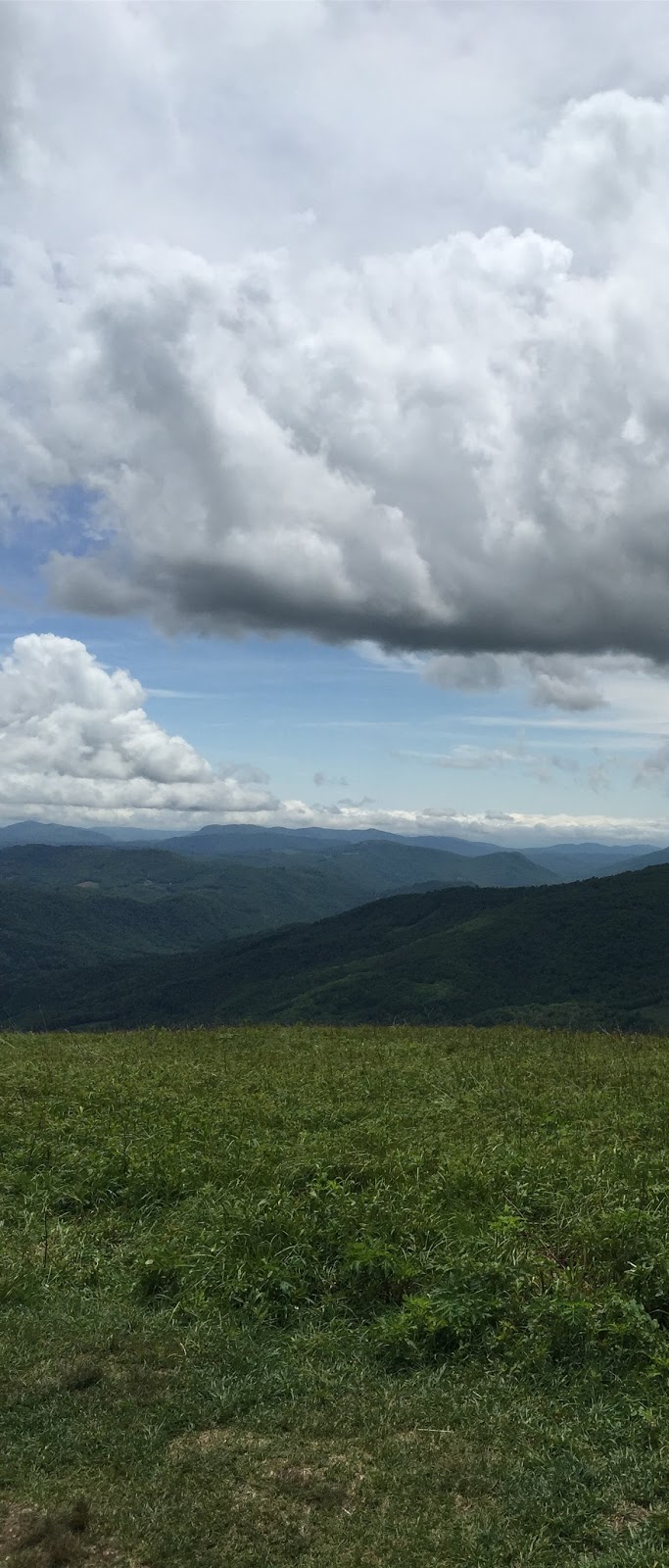
     About a third of the way up Big Hump was the first of three fences. This fence had a V-gate through which one could squeeze their packs, but supposedly through which large farm animals could not pass. When I got to the fence I decided to take a water/power bar break and sat down against the fence without even taking off my pack. I took about a 20-minute break ... the sky was beautiful, a breeze was blowing, I was off my tired feet, and the view was spectacular.


Sitting at the first fence almost to the top of Big Hump ...
this was the best spot on my hike


     Just over the summit of Big Hump is a plaque to Stan Murray, who was instrumental in establishing this trail through the highlands. Leaving the summit of Big Hump--where one could almost see/hear Julie Andrews singing and twirling "... the hills are alive with the sound of music ...."--the trail went down about 900 ft through a rocky and muddy trail ... from the sublime to the not-so-sublime. 
From the ridge just above Doll Flats
     Trail crews had been doing a lot of recent trail repair from Big Hump to Doll Flats and it was pretty much a mess right now. One girl who came through Doll Flats heading to the hostel said, "Those rocks were just plain rude coming down that mountain." I had to agree with her. When I pulled into Doll Flats there were a couple of women already setting up their tent. They had been camped on the outside deck at Overmountain just under where I was spread out. The weather looked as if it were about to change from sunny with clouds to cloudy with rain, so I wasted no time putting up my Hexamid. I went down the hill to get water and found a couple of pipes coming out of the rocks, neither of which were producing much more than a trickle, so it took about and hour to get my four liters for the night/morning.
Leaving NC at Doll Flats
     I put my CC chair up against a log and cooked my dinner in peace, looking southward at the mountains I had just come down. The clouds were rolling in, covering the tops of the closest mountains, but the sun was still shining through the clouds occasionally, so I didn't have to rush to get my bear bag hung and my pack covered for the night.
     As I crawled into my Hexamid, the rains started and storm descended. (See the discussion above about the mist that comes in the cuben fiber tarp.) I covered my quilt with my poncho and went to sleep. I woke up several times during the night to make sure my foot was not sticking outside the bathtub floor, but, overall, slept fairly well. The rain stopped some time during the night--not sure when, and my boots stayed dry under a Tyvek lean-to I had rigged next to my Hexamid. There is no way to remain bone dry in the Southern Appalachians when it rains, so the dampness was expected.
     About 9:30 the following morning, I headed on down the trail to 19E and my vehicle parked at Mountain Harbour. The trip down was uneventful, but seemed longer than it was because my feet were so tired. It was another trail losing elevation that worked on your knees, calves, and feet trying to keep from slipping on rocks and roots. I made it to 19E sometime about noon and walked down to my car in the parking area at Mountain Harbour B&B.
     After I got my hiking shoes/socks off and got my flipflops on I went up to the porch of the hostel right outside the camp store. Several of the hikers I'd met along the trail and at Overmountain were sitting out in the sun trying to decide whether to stay another night or head up the trail a ways. We talked and laughed and compared stories about the section from Roan to 19E. We complained about the steepness of the Hump mountains and the narrowness of the trail through the grass. We compared incredulity about the trail from Little Hump to Big Hump which didn't go the (seemingly) most direct path, but meandered through the woods. The young couple said that they were the ones who hollered at the bear on Little Hump and Theseus told a little more about his experiences growing up.
     Once again, at 70+ years, I learned and re-learned some things ... I learned that cuben fiber isn't totally waterproof ... I learned that the stories and attitudes of the hikers at 400 miles are somehow different from those at 32 miles ... I learned that I never need all of the food I haul on the trail (I should have learned this many times over) ... I re-learned that everyone must truly hike their own hike ... I re-learned that everyone has their own reasons for being on the trail ... I re-learned that most of the people in the woods and on the trails are generous, kind, helpful, and good people ... and that I'm very fortunate to have the health to get out among them.
     When I got back to civilization I looked up a trail journal of a woman--trail name Rue--who was in the 400+ miles of her thru hike when I talked briefly with her. In her last post she'd written about how miserable she was and how she was trying to decide how to get off the trail and back to Delaware. She'd chosen her name from the character in Hunger Games and, after reading her trail journal, I was drawn to a scene in the book where Katniss is talking to Heymich and says, "There is only one winner in the games." Heymich replies to her, saying, "Nobody ever wins the games. Period. There are survivors. There's no winners." Does that describe thru hikers? I hope Rue will stay on the trail ... and I hope Theseus finds whatever he's searching for.
     I wrote in an earlier post on this blog that, for me, the joy was really in the journey, not the destination. I guess, though, that for thru hikers the destination is everything, and everyone who, like Rue, does 400 miles and then bails out feels like a failure ... Maybe I'm glad never to have been a thru hiker ... maybe it's too much about the destination. Maybe I just want to connect with the mountains and "get their good tidings."

Always beautiful to brighten my day!

The elevations of my walkabout


Saturday, May 16, 2015

Old Man on the PCT - July 2014

Last July I flew out to Oregon to backpack with my son, Jeff. I had told him that I could comfortably do about 10 miles a day, which is about half of what he normally does, but he was willing to slow down for his old dad ... or, so he said ...

     We prevailed on Jeff's wife, Amy, to haul us up to Lolo Pass on the slope of Mt Hood. Our goal was to hike to Cascade Locks via the original trail (not Eagle Creek). 
     We got to the pass about 9:00 PM, got a quick photo, told Amy to lock her doors, and headed down the trail in a thick fog. We hiked a couple of miles down the trail and found a spot among the Doug firs to hang his hammock and pitch my Hexamid twin tarp.
     The next morning we were up early and headed to Indian Springs campground, which was about 12 miles on down the trail. Twelve was going to be a tough distance for me, but because we were descending in altitude, I figured I could make it. Some time around noon we passed a sign that said Buck Peak - 1 miles. My trail description said that it was a super view and I was feeling pretty good, so, up we went ... and, gosh, was it worth it. Of course, every time we came to a place with a view, it would almost take my breath away. My son lives out there and he sees these views frequently, but I don't I'm from the south and most of the tops of mountains in the south are thick with trees, so you don't get many views.
The view from Buck Peak
Buck Peak side trail
     After that side trail and a couple of other stops we pulled into the Indian Springs (abandoned) campground. I guess the FS got tired of hauling the trash out, so they stopped keeping it up. There were about 4 or 5 picnic table and Jeff and I found one down by itself and started setting up our stuff. The campsite was not crowded by the other campsites, but it was in view of the privy. 
The setup at Indian Springs
     We went to the spring for water for our supper and found a problem. The spring flow was supposed to be dammed up by a piece of concrete with a pipe through the middle allowing people to fill their water containers much easier; however, the guy getting water just before us had put his hand on the concrete piece getting back to his feet and had dislodged the whole pipe flow. Water was flowing under the concrete and not coming out through the pipe. I tried to adjust the concrete piece, but it was too heavy for me. Jeff asked if he could mess with it and soon the water was again flowing through the pipe as intended. Several other people had come down for water and he was the hero of the hour for fixing the water source. 
The repaired spring
     Interestingly, while I was filling my GravityWorks bag at the spring, Jeff started talking to another hiker who, with some pride in his voice, said he was 60 and had hike 7 miles to get up to Indian Springs. Jeff said that that was really good, then he pointed to me and said that I was almost 70 and had hiked 14 miles to get to Indian Springs that day. Plus, Jeff added that eight months before I had had six bypasses on my heart. The gentleman didn't have much to say after that. His wife, however, who had been down to the spring before to unsuccessfully fill her water bottle, thanked Jeff for fixing the spring to flow through the pipe. I can't remember now what we had for supper, but it was really good. We had both brought fresh bread and Jeff had some good cheese, so we had plenty to fill our stomachs.
     With the aid of a couple of acetaminophens for me, we slept well that night and were up early to try to make it to the next water source somewhere further down the trail. It was July, and a lot of the easy-to-get-to water sources had dried up. We knew we would pass Wahtum Lake and could get water there; we knew we would get near a water source at the Eagle-Benson Trailhead; but we weren't sure about the water source at Teakettle Spring. Most of the literature said it was reliable, but we knew there was some doubt at this time of the year.
The man and his father
     Wahtum Lake was beautiful and we discovered that it had a lot of campsites around the lake, which generally indicated an easier access to the lake. We went to the top of the ridge above the lake and found a FS road that comes up within ½ mile of the campsites. We agreed that we would come back there sometime with the wives to camp. We almost got off the PCT at that place because there we're so many side trails and the PCT has an emblem of sorts and not white blazes like I'm used to on the AT. Anyway, eventually we got back on the main trail and headed on down the trail knowing that we'd need to stop at the north end of Benson Ridge to get some water at Smokey Spring.
     At the edge of the Benson Plateau, where a trail came up from the Eagle Creek area--known at the Eagle Benson Trail, I threw down my pack while Jeff went down to the Smokey Spring and filled the GW bag to filter our drinking water. At that trail intersection there was a log structure of sorts that looked like an old Eagle Scout project gone to disrepair. Jeff said that he was glad to find that spot because he knew that trail came up, but he wasn't sure where it connected to the PCT. We speculated that it might be a fun place to come in the winter and try to make a warm shelter out of the old log structure. Anyway, I was able to lie down and nap a bit while Jeff filled our water bottles/bags for the trip across the Benson Plateau and down the other side. Benson Plateau was interesting ... a long, relatively flat plateau with tall trees and deep grass. (I guess plateau, long, and flat are redundant, huh?)
Water at Eagle-Benson

     We knew that there was a possible water source called Teakettle Spring on the way down when we started losing elevation rapidly. When we got to TS, we decided not to waste time getting water when the spring would have been very labor intensive. It was one of those springs where the water trickled out of the side of some rocks and trickled on down the side of the hill. If we had gotten water there we would have had to scoop out a pool and wait for the mud to settle before being able to fill the filter bag ... and then, it would have taken a lot of time to fill the bag from such a small trickle. Okay, so we decided to hike on and try to find water somewhere below. I had about 3/4 liter and Jeff had about 1/2 liter ... we figured we'd be okay. Well, we figured wrong ... kinda ... we hiked and hiked and hiked and finally found a healthy stream crossing the trail. I kinda dumped my pack and sat down on the side of the trail. Stick a fork in me, I was done! I told Jeff that he was going to have to filter water, I was too tired to move. We both drank and drank and drank. I'm not sure what time it was ... maybe 9:00 PM or so ... still light, though. I told Jeff that I only had the energy to camp nearby if he could find a spot. He went down the trail about a quarter of a mile and didn't see any place that was level enough to pitch my tent. Of course, he was hanging, so he could stay almost anywhere. I checked my GPS and saw that we had done another 14-mile day. 
     Finally, I said, "Jeff, I'm staying right here." 
     He said, "What?!!" 
     I repeated, "I'm staying right here." 
     He said, "You mean, right here in the trail?" 
     I said, "Yup."
Sleeping on the PCT
     So, we threw our kits down in the trail. I thought Jeff would tie up, but he wanted to stay in the trail with me. The trail was really narrow right there: straight up on one side, and down 30 feet to a creek on the other. Jeff said he woke up several times during the night to make sure I hadn't rolled off into the creek. I'm not a toss/turner during the night, so I wasn't worried. Jeff ate bread and cheese for dinner and, after a couple of bites of bread, I took a couple of acetaminophens and crawled under my quilt. I didn't even particularly care that the big banana slugs were crawling across me all night. (Well, you know it's gonna be mice in a shelter on the AT, so it might as well be banana slugs on the PCT.) Jeff was concerned about the rumor of some pumas in the Gorge, but I knew that mountain lions like to chase after runners and antelopes, so I wasn't much worried about them trying to eat a smelly old man who was too tired to move.
Somewhere near that water is 
a cold adult beverage
     The next morning I think I had enough energy to get some Mountain House granola w/blueberries out of my food bag and I actually felt pretty good ... not great, but pretty good!
Banana slugs are interesting critters
     I think we had about 8 miles to get into Cascade Locks, most of the trail would be down hill, and knowing that I had an adult beverage waiting on me when I got there, I was feeling ready to hike. We covered most of the miles talking about how we could have done things differently. We probably should have stayed at the Benson-Eagle intersection, but it just seemed too early in the day to stop. We both still couldn't decide whether spending an hour getting water at Teakettle Spring would have made it better or worse. If we had started the day at Benson-Eagle we wouldn't have had such a long day, so getting water at TS wouldn't have been as critical. Oh, well ... we lived to hike another day ... so, whatever ...
The trail on the Benson Plateau
     When we got to Cascade Locks we went to a restaurant to eat an early lunch. As we were sitting there thinking about getting picked up by our wives, we realized that we were a day and a half too early getting to Cascade Locks, so we were going to have to chill for 36 hrs or so. We found a campground that didn't cost an arm and a leg, drank a few good beers, and talked a lot. It was the first time in years that Jeff and I had really had time to get in to some heavy conversation. It was good!
The Bridge of the Gods (modern version)
     On Thursday morning we walked pack-less across the Bridge of the Gods into Washington. I think she charged us $2 each for the round trip. For all the backpackers who haven't moved across that bridge, it doesn't have a walking lane. You just have to cram yourself against the rail when a big truck passes. When we walked up to where the PCT takes off up the mountain we passed some fresh Marionberries growing by the road. I've had Marionberry preserves but never fresh berries. They are so sweet we stood there and picked and ate for a while.
Getting near Cascade Locks
     We spent some time on the little island across the old locks and wanted to camp over there, but they didn't allow it except during the Trail Days celebration in CL. Thursday evening the women picked us up and after treating us to dinner, gave us a ride back into Portland.
     I love to hike with my son ... love to hike with my daughter-in-law and wife when I can ... but I really love the time on the trail I spent with my son. I seemed to have passed on to him my father's and his grandfather's love for the woods. My father is the one who introduced me to camping when I was very young, and I passed it on to my son when he was very young. What a great legacy! What a great trip!

Finally ... a view of the 
Columbia River to the north


Mark Hatfield Wilderness 
at Wahtum Lake


I seem to be obsessed with signs


A view from the PCT looking back toward Mt Hood


Jeff on a bald on which the trail was marked with
a series of cairns so when the snows pile up one
can stay relatively near the trail.

The old man at Wahtum Lake

The trail on Benson Plateau


Looking west down the Columbia River