Showing posts with label section hiking. Show all posts

Tuesday, June 2, 2015

Walkabout 2015 - Appalachian Trail Iron Mountain Gap to 19E May 2015

Out a window at the parking
lot of the hostel
I had scheduled my annual walkabout at the end of May hoping the rhododendrons would be blooming on the AT, but they weren't ... I guess I picked an altitude too high for the rhodos before June. I swear I thought they would be in bloom this time of year. Ah, well ... as I arrived at the Mountain Harbour Hostel between Roan Mountain, Tenn, and Elk Park, NC, though, I immediately noticed a hikers' shoes and socks in full "bloom" on the deck of the hostel. Stinky feet is not limited to hikers, but is almost always present when hikers are near.
The start of the section hike
     And let me give a plug for the Mountain Harbour Hostel on Hwy 19E near mile 393.8 on the AT. The hostel has been packed every night for the past six weeks and so has the B&B. MH has tent sites also and shuttles section hikers like me all over that region. But the feature I want to make sure you understand is the owner's, Mary's, breakfast ... every hiker I encountered on the trail either knew first hand or had heard that the breakfast at MH was the best on the AT. Mary certainly has my vote. For $12 you can forget how badly your feet hurt or how miserable you've been carrying rain-ladened gear. The showers at the hostel are wonderful, but the breakfast is orgasmic!
Guthook's Guide
     Thankfully, I had made a reservation several weeks in advance for the Saturday night of the Memorial Day weekend. I hadn't paid close attention to the holiday weekend, and, had I waited until driving up to MH, I wouldn't have had a place to stay that night. Anyway, I had made a reservation for a bed in the hostel, breakfast the next morning, and a reservation for a shuttle to Iron Mountain Gap at 363.1 on the AT.
My tarp near the
Clyde Smith Shelter
     Sunday morning after breakfast, David shuttled me to Iron Mountain Gap to begin my section hike. My pack weighed in at 32 lbs, including food. Not knowing how well I could carry my load on that section of the trail, I planned only six miles the first day planning to stay in/near the Clyde Smith Shelter. I honestly don't remember much about the trail on that first day, except that it wasn't particularly difficult. When I got to the shelter a hiker's dog began barking and barking at me ... the owner, Country Gold, introduced himself and apologized for his dog. There was a big camping area around the shelter and I decided to pitch my Z-Packs Hexamid Twin instead of staying in the shelter. As other hikers began to arrive, Sunshine, the dog, barked at everyone until Country Gold introduced himself. At some point, I began to discern that Country Gold was hearing impaired and his service dog was trained to bark to alert him to something/one coming near. After Country Gold introduced himself, Sunshine wouldn't bark at that person anymore.
     The weather was wonderful and I had a good setup, so the night was very pleasant and the meal preparation went well. 
My little pill bags
Looking off Little Rock Knob vista
     I had heart surgery a couple of years ago and have to take prescription meds every morning and every evening. Last year on my walkabout I stuffed all my meds in a big container and each morning and night had to pour them out on a bandana and sort through the pile until I found the meds I was supposed to take. Sometimes that's not easy when the weather conditions aren't great. This year I purchased some small 2X2 ziptop bags and wrote "AM" and "PM" on them to make the daily taking of meds much easier--sixteen little baggies for my walkabout. Worked perfectly and I didn't drop any meds or forget to take them ... 
Guthook's app for
Cloudland Park
     Monday morning I awoke, ate some oatmeal, and got on the trail about 9:30 ... which I thought was good, except when I went by the shelter and through the campsite, I was the last one to leave. Oh, well ... I slept pretty well and felt good for my second day. I wasn't looking forward to that day's trail, because I had to lose about 500 ft of elevation down to Hughes Gap and then began two huge climbs. The climb up and over to Ash Gap was over 1200 ft gain, and then another 900 ft gain up to the Roan Mountain/Cloudland Park area. For me, it was an all-day hike. My plan was to stay at the Roan High Knob shelter, but several SOBOs who passed me said that they had spent a very cold and windy night at the shelter; plus everyone was saying that a big storm was blowing in for the night. I thought that I would see if I could find a place in the trees before the park area to pitch a tent and hunker down for the night.
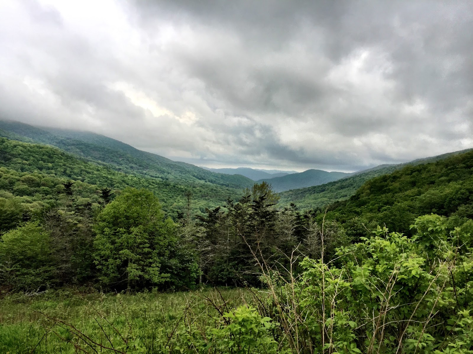
     The trail down to Hughes Gap was fairly uneventful. I stopped to look out over the valley from Little Rock Knob and got a passing hiker to take my pic. The view was nice, but not spectacular ... I've hiked too much in the west, I guess ... 
A lonesome rhodo near the
Cloudland Hotel site
     I crossed the road at Hughes Gap and started up the mountain ... and it was unrelentingly upward. Interestingly, AWOL's guide doesn't have anything listed between Hughes Gap and Ash Gap except a water supply back by Hughes Gap. It's one of those trails where you don't have the opportunity to look around much; you're just looking at where your feet will land on the trail. There are lots of "steps" typical on the GA/TN/NC AT ... big boulders that trail crews have pulled about to give the hiker something to step on to get to the next level. It's not fun, and it's not easy for old legs. 
Typical AT trail
     At Ash Gap's big campsite I was greeted with Sunshine's barks letting Country Gold know that I was coming into the camping area. CG introduced himself again, we shook hands, and Sunshine quit barking. I took my pack off and asked about the water source. CG told me that there was a water source down--way, way down--the hill, so I grabbed my water bottles and headed down ... and, dang! He wasn't exaggerating ... from way down by the spring I heard Sunshine bark a couple of sets, so I knew others had pulled into the campsite. Soon a guy and a girl came down to get water just as I was finishing. Of course, we talked about the hike down to the spring and the impending hike back up to the campsite.
Typical AT stream crossing
     Getting back to Ash Gap, CG told me he was done for the day and was climbing in his tent for a nap. We talked for a while and he said that he had been on the city streets for a while, then someone turned him on to the mountains and he'd been on the trail ever since. Sunshine started barking and another couple came in to take a break and get some water. This couple--a young twenty something--I would see several times throughout my hike ... although I never did get their names. The guy had Guthook's app on his phone and  he showed me the elevation from Ash Gap into the Cloudland Park area ... a pretty steep looking up. I said I would see them before Cloudland when they passed me, and I packed up and headed uphill. Phodo and two followers--one with a lute and one with two interlocking hulahoop-looking things--passed me somewhere after Ash Gap. He was shouting some sort of rant when he went by, reminding me of Del Gue's rant when he parted ways with Jeremiah Johnson. The two followers were pulled off the trail playing on a lute and singing while Del Gue/Phodo went on down to the facilities. I ran into Phodo again later, but never saw the lutist or the hoopster again.
From Carver's Gap looking
up to Round Bald
     As I got closer to the top, the weather got increasingly worse, and when I pulled into the Cloudland area, a typical cloud bank was blowing in and closing down any views. I took off my pack and went to the restrooms at the park area, then tried to decide what to do for the night. Some hikers--Phodo, Theseus, and the young couple--at the restrooms (the only porcelain on my section hike, so everyone was taking advantage of it) were talking about the storm that was supposed to hit that night, and, judging from the current wind and clouds, didn't look like I was going to have a dry evening.
Mountain storm rolling in
     The signs on the kiosk at the restroom said no overnight camping in the park area, so I went back down the AT a bit and found some trees under which to pitch my tent. By that time it was raining, so pitching my Hexamid without filling the bathtub floor with water was a challenge. "It was a dark and stormy night ..." so I secured my food in a bear bag and climbed into my tent for the night. I ate a power bar and drank some water, so I wasn't famished when I climbed under my quilt.

     Okay, so here's my two cents on the discussion about cuben fiber tarps/tents: does the cuben fiber leak in a hard rain, or is it a tympani effect of spraying the condensation from the inside of the tarp down on you? That first night of rain, I had been in my Hexamid for an hour or so when it started to really rain hard. I lay there and felt a definite mist coming down in my face from the cuben material. I figured it was the condensation misting down on me from the very large, hard drops of rain hitting the outside of the tarp. However, it rained hard on me a couple of nights later just after putting up a completely dry tarp and not having been under the tarp long enough to build up condensation and the mist still camp down. My thoughts now are that the material does permit some of the moisture from a hard rain to mist through ... but I wouldn't swear to it. My son says there is a big discussion on BPL about that very topic. I'll have to dial in to that and see what those guys have to say. Anyway, what I did the second night in the rain was spread my Z-Pack cuben poncho over my quilt to prevent as much mist from reaching my quilt as possible. My quilt was damp the first night when I didn't spread the poncho over me, and dry the second night when I did. Of course, given the slick nature of the cuben poncho, I had to keep waking up during the night to make sure the poncho had not slid off. 

     Neither night did I sleep great, but most of the time in the woods I don't sleep great anyway because I'm a very light sleeper. I take earplugs for sleeping in shelters, but if I'm sleeping in a tent I want to be able to hear in case a critter comes stomping around my campsite.
     The next morning I packed my damp stuff ... I should have made coffee and eaten a proper breakfast, but it was still that mountain wind and cloudiness stuff, and, if I was going to hike in the rain/wind it would take me longer, so I just drank water, ate a power bar, peed in the porcelain, refilled my water bottles, and headed on down the trail. I knew I had a drop in elevation from the Cloudland Hotel to Carver's Gap and then a climb up and over Round Bald, Jane Bald, and around Grassy Ridge Bald before heading on to Yellow Gap.
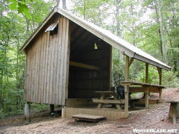
Overmountain Shelter
     I was really hoping for clear weather for the balds, but didn't get it. At least it wasn't raining ... but I had really hoped for views from the balds. Round Bald was a pull for me with a heavy, moisture-laden pack. I saw the young couple's tent in the trees halfway up the trail. They had said they were going to try to make it to Overmountain before the rain set in, but, evidently, had decided to pitch under the trees with a wind break on their western side. At the restroom the afternoon before, Theseus had said he was going to try to make it to Grassy Ridge Bald to catch the sunset, but obviously that didn't happen in the stormy weather. I never did know where he was hanging. Phodo was somewhere out there, too, but I never saw him with his entourage until the next day. Jane Bald was hard on the old legs, but at least I didn't have to top out on Grassy Ridge Bald. The trail slabbed the side of it.
     The young couple passed me somewhere on the side of Grassy Ridge Bald and were breaking at the Stan Murray Shelter when I went by. I commented that they'd have to pass me again, but the trail wasn't too tough into Yellow Gap, so I was at Overmountain when they arrived.
From the loft inside Overmountain Shelter
     I have seen photos of Overmountain and it's usually a feature on every video of this section of the AT. I've always wanted to stay there and was really glad to find that it was not yet crowded when I arrived. Since some were predicting a storm during the night, I had decided that I wanted to stay upstairs inside the loft. I found a corner and staked my claim as the shelter quickly began filling up. The culture of Overmountain is interesting. There were several tents pitched upstairs--at least one so it could dry out from the night before. A couple of tents were pitched so the occupants would have some seeming protection from mice scurrying about at night--although I didn't ever see/feel any run across me. There was a woman upstairs--among the 20 or so sleeping there--who was accompanied by the largest trail dog I had ever seen. The dog was older, though, and very well-mannered, so he was no problem. The young couple pitched their tent and climbed in. The owners of one of the tents had decided to move outside after some complaints that their tent took up too much room--it really didn't ... but the woman who was with them kept her tent pitched inside. Probably three-fourths of the people upstairs were solo hikers and could spread their pads where ever they could find a 25X72 space on the floor.
Irises growing near
Overmountain Shelter
     After I ate a Packit Gourmet meal of Potato Samosa (a little too spicy for me that night), I took my Crazy Creek chair out and sat to watch the evening with a half dozen other shelter occupants. Theseus was out there and holding court. Theseus is a 19-year old, very intelligent, very clever/funny, who is recovering from the death of his father earlier this year in a kite-skiing accident. Theseus hikes in a skirt; an idea I have thought about on several hot and humid occasions.
     We sat out there well after hiker midnight and I finally decided not to fight it anymore and get on my little pad, put in my earplugs, and catch some much-needed sleep. I was told the next morning that it stormed loudly during the night, but I never heard a thing. I was tired from not getting much sleep the night before and tired from hiking in an old body, and it was really good sleep for me.
     I woke the next morning with someone standing over me ... it was the old dog, who, evidently smelled my morning breath from across the way and had strolled over to check it out. He sniffed my mouth, kind of snorted, and strolled back to his pad across the loft. It's always helpful for someone to tell you that you need a breath mint before getting close to anyone in the morning. Thanks, old buddy!
Overmountain Shelter from the ridge
 heading up out of Yellow Gap
     Most of the folks who were packing up were headed to Mountain Harbour nine miles up the trail ... well, down in elevation, actually ... Some of them expected to get a place in the hostel, but I told them that a hiker I'd passed had called from Carver's Gap and the hostel folks had said that every bed was reserved for the rest of the week. There were $10 tent sites, however, which included a shower, and anyone could make a reservation for breakfast--which I strongly encouraged them to do. Someone asked me if I was headed to Mountain Harbour and I said that I was only going to Doll Flats because I was only section hiking and not in any hurry to get out of the woods.
     The climb out of Yellow Gap was continuous and soon I was heading up the side of Little Hump, and 800 ft gain from Overmountain. The trail up Little and Big Hump is a foot-deep trough in a field of heavy grass in which one can only place his/her feet one in front of the other. Just as I started up Little Hump, I heard some shouting and saw a bear run out of the woods near some rocks, bound across the hillside, and run into the woods. It was the first bear I had seen since two years ago on my section hike down in Georgia. 
     Another part of the challenge is that the trail goes straight up the side of Little Hump and there are a couple of false summits leading one to believe that he/she is closer to the top than he/she actually is. Finally I reached the summit of Little Hump, paused for a moment, looked over to Big Hump and wondered why the trail snaked into the woods and didn't just go down the side of Little Hump to Bradley Gap.
     When the trail finally came out of the woods and bottomed out at Bradley Gap, I looked up to three or four more false summits. Again the trail was a foot-deep trough about ten inches wide. I was exceedingly happy that it was not pouring rain because that trough would have become a foot-deep stream coming down the mountain. Looking to both sides of the trail up through the grass one could easily see where the previous iterations of the trail had been. Evidently, when the trough gets too deep to walk in, the hikers begin to make another trail just beside the trough. In several places I could see where other hikers got tired of walking the trough and started another path up the side of the hump.
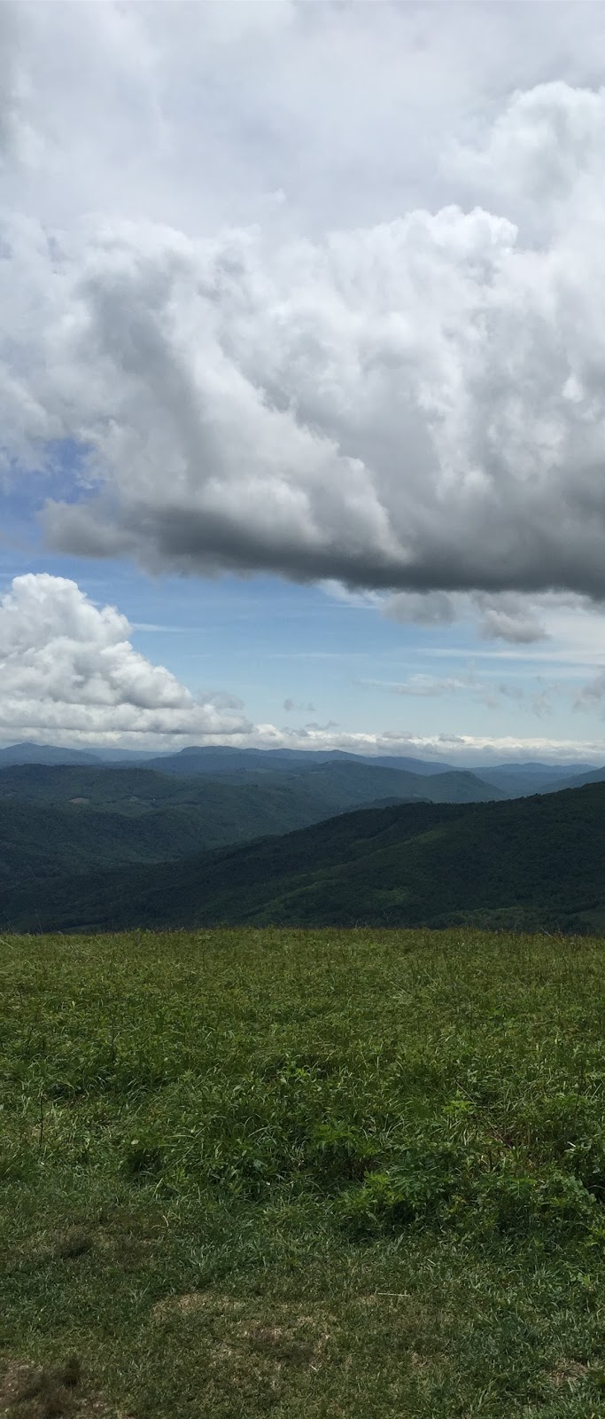
     About a third of the way up Big Hump was the first of three fences. This fence had a V-gate through which one could squeeze their packs, but supposedly through which large farm animals could not pass. When I got to the fence I decided to take a water/power bar break and sat down against the fence without even taking off my pack. I took about a 20-minute break ... the sky was beautiful, a breeze was blowing, I was off my tired feet, and the view was spectacular.


Sitting at the first fence almost to the top of Big Hump ...
this was the best spot on my hike


     Just over the summit of Big Hump is a plaque to Stan Murray, who was instrumental in establishing this trail through the highlands. Leaving the summit of Big Hump--where one could almost see/hear Julie Andrews singing and twirling "... the hills are alive with the sound of music ...."--the trail went down about 900 ft through a rocky and muddy trail ... from the sublime to the not-so-sublime. 
From the ridge just above Doll Flats
     Trail crews had been doing a lot of recent trail repair from Big Hump to Doll Flats and it was pretty much a mess right now. One girl who came through Doll Flats heading to the hostel said, "Those rocks were just plain rude coming down that mountain." I had to agree with her. When I pulled into Doll Flats there were a couple of women already setting up their tent. They had been camped on the outside deck at Overmountain just under where I was spread out. The weather looked as if it were about to change from sunny with clouds to cloudy with rain, so I wasted no time putting up my Hexamid. I went down the hill to get water and found a couple of pipes coming out of the rocks, neither of which were producing much more than a trickle, so it took about and hour to get my four liters for the night/morning.
Leaving NC at Doll Flats
     I put my CC chair up against a log and cooked my dinner in peace, looking southward at the mountains I had just come down. The clouds were rolling in, covering the tops of the closest mountains, but the sun was still shining through the clouds occasionally, so I didn't have to rush to get my bear bag hung and my pack covered for the night.
     As I crawled into my Hexamid, the rains started and storm descended. (See the discussion above about the mist that comes in the cuben fiber tarp.) I covered my quilt with my poncho and went to sleep. I woke up several times during the night to make sure my foot was not sticking outside the bathtub floor, but, overall, slept fairly well. The rain stopped some time during the night--not sure when, and my boots stayed dry under a Tyvek lean-to I had rigged next to my Hexamid. There is no way to remain bone dry in the Southern Appalachians when it rains, so the dampness was expected.
     About 9:30 the following morning, I headed on down the trail to 19E and my vehicle parked at Mountain Harbour. The trip down was uneventful, but seemed longer than it was because my feet were so tired. It was another trail losing elevation that worked on your knees, calves, and feet trying to keep from slipping on rocks and roots. I made it to 19E sometime about noon and walked down to my car in the parking area at Mountain Harbour B&B.
     After I got my hiking shoes/socks off and got my flipflops on I went up to the porch of the hostel right outside the camp store. Several of the hikers I'd met along the trail and at Overmountain were sitting out in the sun trying to decide whether to stay another night or head up the trail a ways. We talked and laughed and compared stories about the section from Roan to 19E. We complained about the steepness of the Hump mountains and the narrowness of the trail through the grass. We compared incredulity about the trail from Little Hump to Big Hump which didn't go the (seemingly) most direct path, but meandered through the woods. The young couple said that they were the ones who hollered at the bear on Little Hump and Theseus told a little more about his experiences growing up.
     Once again, at 70+ years, I learned and re-learned some things ... I learned that cuben fiber isn't totally waterproof ... I learned that the stories and attitudes of the hikers at 400 miles are somehow different from those at 32 miles ... I learned that I never need all of the food I haul on the trail (I should have learned this many times over) ... I re-learned that everyone must truly hike their own hike ... I re-learned that everyone has their own reasons for being on the trail ... I re-learned that most of the people in the woods and on the trails are generous, kind, helpful, and good people ... and that I'm very fortunate to have the health to get out among them.
     When I got back to civilization I looked up a trail journal of a woman--trail name Rue--who was in the 400+ miles of her thru hike when I talked briefly with her. In her last post she'd written about how miserable she was and how she was trying to decide how to get off the trail and back to Delaware. She'd chosen her name from the character in Hunger Games and, after reading her trail journal, I was drawn to a scene in the book where Katniss is talking to Heymich and says, "There is only one winner in the games." Heymich replies to her, saying, "Nobody ever wins the games. Period. There are survivors. There's no winners." Does that describe thru hikers? I hope Rue will stay on the trail ... and I hope Theseus finds whatever he's searching for.
     I wrote in an earlier post on this blog that, for me, the joy was really in the journey, not the destination. I guess, though, that for thru hikers the destination is everything, and everyone who, like Rue, does 400 miles and then bails out feels like a failure ... Maybe I'm glad never to have been a thru hiker ... maybe it's too much about the destination. Maybe I just want to connect with the mountains and "get their good tidings."

Always beautiful to brighten my day!

The elevations of my walkabout


Monday, July 1, 2013

Section Hiking the AT: Springer Mtn to Neel Gap - June 2013

I'm not sure what got into me last fall, but I decided that I'm young enough to hike a couple of sections on the AT before I reach age 72. My first hike on the AT was when I was 12 years old in 1957 when I hiked from Newfound Gap to Charlie's Bunion and then went back down to where the  Boulevard Trail intersects with the AT and goes across to Mt. LeConte. Since then I've hiked on the AT at several points, mostly in the Smokies, but never just a section hike in the traditional since. Last summer on my annual walkabout, when I was day-hiking around Roan Mountain, I decided to pick a section of the AT and go at it. The most logical section, of course, is the first 32-mile section from Springer Mountain to Neel Gap (referred to on maps as "Neel's Gap," but the locals say "Neel Gap"). This section of the AT is probably the most hiked section of the AT since hundreds and hundreds of people set out on this part intending to thru hike and then drop off after a few weeks. I had day-hiked up to the summit of Springer before, checking out the plaques and first White Blaze for northbound hikers, and I was inspired (or something) and decided, heck, yeah: I can do this ...
Sign inside the hostel

Throughout the winter I kept telling people that I was planning to do this, hoping that if I told enough people I wouldn't be able to back out. I trained a little bit in the six weeks or so before I scheduled to hike; and the smartest thing I did was train in the shoes in which I planned to walk the 32 miles. Of all of the stuff I've read and vidclips I've watched, a lot of warnings are given about the feet. I've been told that a person's feet eventually get used to the daily grind, but maybe that's for most people. Of course, on this section hike I really didn't hike long enough to get my trail legs and feet under me, so I can't say for sure that it would have happened ... but, anyway, no blisters. I bought my shoes a half-size up and trained in them. It seemed to work for me.
Walasiyi-Inn Dining Room

On Tuesday, 18 June, I drove from Mississippi to Neels Gap, Georgia, to check in to the Mountain Crossings - Walasi-yi hostel ($16.05) for the night. The folks there at the outfitters are very, very helpful, and, through them, I had arranged a shuttle with Lumpy (who lives at Neel Gap) from there to the Springer Mountain parking lot. Because I was not positive that I could keep the 8+ miles-a-day pace and, thus, confirm the day/time back to Neel Gap, I had decided to leave my vehicle at the Byron Reece Trail parking area, get a shuttle to Spring Mtn, and hike back to my car. That way, if I took an extra day or two, I wouldn't have a shuttle trying to hook up with me. It turned out to be a very good plan. Wednesday afternoon, after throwing my gear on a bunk at the hostel, I hunted up Lumpy and confirmed our start at 7:30 the next morning. Lumpy and Pirate had just returned from a two-day R&R trip to the Gatlinburg area and he looked like he could use a good night's rest.
At the Springer parking lot

I met Lumpy in the parking lot at 7:30 AM and began the 33 mile--hour and a half trip to the Springer Mtn parking area. I tried to keep up with all of the turns and road forks, but soon found that being able to find my own way to Springer via Lumpy's way would only result in my getting hopelessly lost in the hills. During the hour-and-a-half trip, Lumpy entertained with down-home stories of mountain life ... some of which I actually believed. When we finally arrived at the Springer Mountain parking area, Lumpy pointed the way north and told me to "follow the white blazes." Evidently, he shuttles a lot of people who get out of the car and don't know the difference between a white blaze and a blue blaze, and don't know whether they are heading north or south. And I did meet a woman later on on the trail who was really confused ...


The first 8 miles of the AT heading north is mis-leading in its level of difficulty--it is deceptively easy. From the top of Springer, at about 3800 ft of elevation, to the stream crossing at Three Forks, at 2500 ft, the trail is easy and down hill most of the way. Even climbing out of Three Forks up and over Hawk Mtn is not exceedingly steep and difficult. I was thinking to myself, "Hey, I can do this without too much of a sweat." Day two would be a jolt of reality. But I got to the Hawk Mtn shelter with some energy to spare. A few hundred yards before I got to Three Forks I spotted a bear cub in the trail at the same time he spotted me. He ran--I froze! I stood there banging my poles together and talking out loud so the sow would know where I was and hopefully that I was not a threat to her cub. I stopped on a log just over the bridge at Three Forks to have a snack and refill water bottles, and, while I was sitting there, a woman hiker came by and we chatted a moment about our hike so far. She had started before me but had gotten on the wrong trail (Benton MacKaye, maybe?), hiking an extra three miles, she said. She said she was trying to make it to the Gooch Mtn shelter that night, but had a tent if she didn't make it all the way, so she set off on a pretty fast pace.


When I got to the sign pointing off the AT to the Hawk Mtn shelter, the woman  that had passed me at Three Forks was sitting against the post eating a snack. She stood up as I approached and, looking at her watch, said she'd have plenty of time to make it to the Gooch Mtn shelter before dark. She loaded on her pack and headed off at a fast pace ... the wrong way right back up the trail we had just come down--obviously confused again. I started to say something to her, but thought she might have changed her mind, and hoped that, if she was again confused, it wouldn't be too long before she realized that she had just hiked down the same trail. Later I asked some people who had come down the trail if they had passed her. They said they had not, so I figured that she had discovered her error and turned around.


One thing I've always tried to do when I've gotten to a blue blaze trail to a shelter/water/etc. is to make sure I know which way to turn when I come back out of the blue blaze trail. And while the trail there made a 90 degree turn and was somewhat confusing, I don't think I would have headed back up the same trail I had just come down a few minutes before. I never did run into the woman again ...

Arriving at the Hawk Mtn Shelter at 8.1 miles, I was disappointed to see so much trash around the fire ring. Obviously, some worthless backpackers had not worried about carrying out their own trash and just thrown it in the fire ring. "Hey, dummies! Tin cans don't burn and somebody will have to carry your trash out!" I just cannot understand how backpackers can be so self-centered that they don't care about the environment or other backpackers. Members of the millennium generation, I guess ... pisses me off! If I hadn't been on the first day of my 4.5-day trip I probably would have carried some of the trash out.

At the Hawk Mtn shelter I quickly hung up my pack and threw down my sleeping gear in the corner of the shelter to claim my spot. I could see one tent about 75 yds away in the tenting area, but only caught a glimpse of a spectre of a person who might/might not have belonged to that tent. For some reason my sightings of the guy walking back and forth through the woods reminded me of those supposed sightings of Sasquach ... a little spooky. Anyway, I grabbed my water bottles and bags and headed down to the spring to get enough water for the evening's meal and breakfast oatmeal and coffee. Just after I got back to the shelter, three more hikers walked in. One of them said he was staying the night, the other two said they were refilling water bottles and heading to Hightower Gap for the night. They all three headed down to the spring for water.


Hawk Mtn shelter
The hiker staying the night was named "Wilbur J" or something and he and I immediately started talking about gear. Do hikers talk about anything else? He was an Ewok with a Hennessy zip and said he was going to hang it back behind the shelter. Of course, when he said it was a Hennessy zip, I asked why he hadn't gotten the classic, and if he'd gotten the snake skins. He said he hadn't gotten the classic because he was afraid he'd fall out during the night, and he thought he would save $20 by not getting the snake skins, but he realized that he'd make a bad decision on that. I paid attention to our conversations, because I'm contemplating a bug-free hammock and like to talk to users. He hung his hammock and came back to the shelter to eat dinner and talk. Wilbur J was a friendly guy from Woodstock, GA and claimed to be a high school choral music teacher. He and I were to hook back up the next two nights, too, although he hiked faster than me. He also had an Esbit cook kit that boiled about 900 ml at a time. I've never used Esbit--I'm an alcohol stove or canister man myself--but I was interested in what he thought about it. I've read some scary stuff about Esbit fumes when it gets wet, but it is light and efficient, so a lot of hikers use it regularly. I have an Esbit stove, but have never used it. I used a Whitebox alcohol stove on this trip with an MSR Ti 1.5L pot inside a Caldera Cone made for the pot. I love it and it boils the large amounts of water I need for my meals and drinks.


While we were fixing our suppers, a woman and her young son came in. The kid was about 12 and had been a scout, so this was not his first experience. They were planning to hike to Gooch Mtn shelter the next day, although the mom said her son started complaining about two miles from Springer. They pitched a tent about 40 yds behind the shelter. At the table we had a good time talking to the kid about his experiences--that's always fun. Just before dark a 20-something male/female couple came in and, after fixing something to eat, pitched their tent in the loft of the shelter saying they wanted some protection from the bugs and mice. Pitching a tent in the shelter seems like overkill to me, but if a person doesn't like bugs and mice, or if it's pouring rain and the shelter roof leaks, it's probably a good idea. Since there were no other hikers arriving, there was plenty of room in the shelter for them to pitch their tent. I slept pretty well that first night, falling asleep to thoughts about how lucky I was to be in a shelter on the AT.


Flaming azaleas
The next morning while everyone was eating breakfast and packing up, we all chatted about our plans and Wilbur J, the mom/son, and I said we would see each other that evening at Gooch Mtn shelter. The young couple had just come out for the night and were heading back to Springer that day. I was the first to set off, because I figured I was the slowest hiker and the others would catch up and pass me ... a lot of women hike faster than me, but I was going to be embarrassed when a slightly overweight 12-yr old passed me.

The second day was not particularly fun for an out-of-shape old man. From the Hawk Mtn shelter (8.1) I hiked down to Hightower Gap; then up and down, up and down, up and down, and up and way down in the next few miles, finally bottoming at Horse Gap. Then I hiked way up and back down to Cooper Gap at 12.2 miles. Honestly, I wouldn't even remember passing Cooper, except for the explosions, but the maps said I did. Then I went back up and over another mountain down into the Justus Creek bottom where I refilled my water bottles. Up a little from Justus Creek is a camping area called Devil's Kitchen where a couple of guys were setting up for the night. The only thing I remember about the day's journey (in addition to the constant ups and downs) were the combat soldiers--seriously! There is an Army training camp somewhere up in the woods above Dahlonaga--I know for sure because I drove up on it last year by mistake ... signs all over the place saying that if you got any closer you would disappear and never be heard from again. So, anyway, while I was hiking I could hear gunfire and explosions all over the woods. I could see trails where the troops had come straight down the mountain across the AT, 40 troops at a time tearing up the ferns and azaleas. I was hiking along thinking about how my feet hurt and looked up and the troops were all deployed in perimeter security on both sides of the trail--full camo uniforms, paint, and 60 lb packs. I passed through quietly and spoke only to the platoon sergeant at the end of the line saying, "What up, Sarge?" to which he returned a grunt. I thought about one of my friends who will be a junior at USMA-West Point and how he has to play in the woods sometimes. Later at Cooper Gap, as I was resting my feet, some more troops came out of the woods with a lot of gunshots, explosions, and shouts, to set up a perimeter around the gap. Maybe that all happened at Horse Gap ... I really don't remember. I just mostly remember that my feet hurt. I crossed Blackwell Creek at 15.5 and climbed a little to the blue blaze leading to the Gooch Mtn shelter at 15.7. Fortunately, the total mileage was a little shorter because the pretty severe ups and downs got to me. The second day of a trip is generally tough and I was mentally prepared for things to hurt the second day--and I wasn't disappointed. I knew I had enough food for five days and Lumpy's phone number, so I wasn't greatly concerned. When you know it's going to be painful, and it is ... well, maybe it doesn't hurt so much. I was certainly relieved when I got my boots off and my Crocs on at the shelter.


Gooch Mtn shelter (from White Blaze.com)
The Gooch Mtn shelter was in better shape than Hawk Mtn. Although I had passed a guy who was south bound and he had said that Gooch was trashed, it was much cleaner than Hawk toward which he was headed. I warned him that Hawk had been really trashed. There was trash at Gooch, but not nearly as much as at Hawk. Another reason that Gooch was better was that the roof/canopy came down over the table and had a cooking shelf on which to keep the stoves off of the table. Wilbur J was already at Gooch when I arrived but hadn't hung his hammock because he was considering staying in the shelter. He lay down on his pad in the loft and I lay down on my pad on the bottom and we both went sound asleep for about 45 minutes. When Wilbur J woke up, since it was late in the day and no one else had come in, he decided to pitch his hammock in the loft of the shelter. Even if a whole group came in, there were still a number of spaces down with me and plenty of room to throw down under his hammock. Of course, just as soon as he got his hammock up several more people arrived--four in all--plus one thru-hiker trail dog. They all decided that WJ might step on them in the night, so they decided to set up on the lower floor with me.
Mountain Primrose

Two of the women were from New Hampshire and had started their thru-hike in April 2012 on Mt Katahdin. However, when they got to New Jersey, Hurricane Sandy hit and since they were both travel nurses, they stopped their hike to work in the Northeast after the storm. They had resumed their trek this 2013 spring and were about to finish at Springer the following Saturday. They planned to hike the 13 or so miles to the Stover Creek shelter the next night where some friends would meet them with a huge bag of Chick-fil-A nuggets and several boxes of wine. Saturday morning they would get up and hike the two miles to the top of Springer where their family and friends would be waiting on them. These two women had the best trail dog I have ever met or heard of. His name was Georgy--trail name "Bear"--and was the easiest going big dog. He didn't say a word the whole time, slept at the foot of the women in the shelter, and got up several times during the night to circle the perimeter, then return to their foot. I heard him drink water once, but other than that, he was silent as a big dog could be. Georgy had been with them the entire thru hike except for a short time he had an encounter with a porcupine and spent some time with a vet. What a great trail dog!

A friend of theirs had met them somewhere back up the trail and hiked in with them. I think he said he had met them somewhere along the trail in 2012 and had already finished his thru hike--or maybe I made that up. Anyway, he knew them pretty well and they had invited him to finish their thru hike and celebrate--plus he hiked in with a box of merlot that one of the women particularly enjoyed. Another woman had hiked in from the south and decided to stay in the shelter that night, also, so there was a lot of chatting and story-telling that night. It was one of those fun experiences one gets on the trail when people that will probably never meet again talk and tell stories as if they were old friends--it's trail magic. So we were going to be a pretty full shelter that night; however, not nearly as full as the shelters get in March and April when the NoBos come through. Everyone in the shelter snored and participated in the shelter shuffle, even WJ in his hammock up in the loft. I seemed to be the only one who didn't have ear plugs ... well, actually, I had a pair, but didn't want to dig them out of my pack when I realized that I would need them. It was kind of fun sleeping with a shelter full of experienced hikers. I had fun that night and the next morning listening to stories about the nurses' thru hike and about the trail angels they had met when Georgy had the encounter with a porcupine. I also enjoyed the other woman's stories about being somewhat of a newbie on the trail. It was fun to hear the contrast of experiences of one so new to the trail and a couple who were finishing the 2181 in two days. There is much to learn about oneself on an AT experience.

Friday morning I ate and packed up early, but not so fast that I didn't savor my camp coffee and oatmeal. Gracious! Do I love coffee in the woods! Everyone seemed to struggle to get moving that morning, or maybe it was a reluctance to part ways with new friends each knew they'd probably never see again. I was heading to the Lance Creek Restoration area to tent camp for the night. I knew WJ would pass me somewhere along the way and said that perhaps we could meet at Woody Gap (21.0) for lunch. We met for lunch at Woody, a big area where a paved road comes through, and then set out for Lance Creek. I knew WJ would arrive before me, so I told him to save me a space if the tent sites started to fill up.

I got to the Lance Creek area (24.4) about 4:30 and set up my tent quickly as it began look like rain. Much of the area that had once been camping sites along Lance Creek has been roped off for restoration purposes. Up on kind of an old road bed there were four pads for tents but no bear cables. I had enough time to go down to the creek and get enough water for supper and breakfast and soak my tired feet before the thunder, wind, and rain descended in the creek bottom. I have a Tarptent Rainbow which has to be nursed a little around the edges so that the drip-off doesn't run down the netting and into the tent. With a little work I was able to keep my gear inside the tent pretty dry. When I got to Lance Creek, WJ had already strung up his hammock and was talking with two women camped there who had hiked in from Springer ... well, they kind of hiked in from Springer. It seems that when they got to Cooper Gap, they broke down and talked someone into giving them a ride to Woody Gap from where they hiked to Lance Creek. One of the women lamented that even though they had done a lot of online research about the first section of the AT, they had not realized that it would be as tiring as it had been. They believed that they had pretty good equipment, but their packs were heavy and they were really tired. They were really down about being so tired. Then just before the rains descended a young man and woman came in and quickly pitched their tent on one of the four pads. They were from Boston and had started at Springer, hiked 20 days north, turned around and were hiking 20 days back to Springer. This was day 38, so they had two more days to get there. I'm not sure what the deal was about 40 days (Biblical, maybe?), but that's how long they were planning to be on the trail.


It rained for about an hour while I dozed and thought about my hike thus far. The pitiful part was that I'd only done 24+ miles in three days and I was tired--but obviously not as tired as those two women. Most of those dudes can do 16-20 in a day and not be as tired as I was. There is something to be said for getting this done when you're young--or at least young-er. When I had commented to a hiker along the way that I had gotten out of shape and was determined to get in shape, he told me that I'd need about a month on the trail before I would be in shape to hike longer distances and not hurt so much. Even though my feet had hurt--as I knew they would--each morning when I put on my shoes, my feet felt pretty good. I was happy about that.

When it stopped raining, I fixed supper and looked for a limb over which to hang my bear bag. I found one that would keep my stuff up about 12 feet, and figured that unless a tall bear came along, I was okay. Of course, throwing a bear line over a tree limb after a hard rain brings its own shower, so I was a little bit wet when I brushed my teeth and climbed into my tent. I didn't sleep well that night and the two women woke and decided to have a conversation in their tent at 4:00 AM. They were obviously so new to the trail that they didn't know how sounds carry in the woods at night. They must have awakened everyone because WJ and I talked about it the next morning. The rain had brought a lot of humidity to the forest and I slept fitfully and woke in the morning with a stopped up nose. When it's warm and humid in the woods, you can't sleep covered because it's too warm--but you can't sleep uncovered because it's too cool with the humidity. It generally brings a night of cover-uncover all night long.

Saturday morning I talked a lot with WJ a lot before we set out. He told me that while he was hiking the day before he had changed his trail name to Gilligan. I thought that was a much more fitting name for him because for some reason he kept falling off of stuff and sliding down hills. The first day he slid down the trail to the Long Hollow Falls and slid some more on the rocks of the falls. The second day he had slid down a rock twice while trying to sit on top to eat some lunch. The third day he had fallen and slid down to the creek at Lance Creek. Each time he had fallen/slid he popped back up with a smile, saying something like, "I'm good! I'm good!" Gilligan was a much better name for him and I congratulated him on a good change. 

The two women packed up and left before me, and, although I didn't see which way they went, I thought later that they must have headed back toward Woody Gap to get a ride out. Gilligan left the site before I did because he wanted to get over Blood Mountain and out to the hostel at Neel Gap to wash some clothes. (His clothes were pretty muddy from all of the sliding down!) It was a little sad to see Gilligan leave. He seemed to be a super guy, a school teacher (choral music) in Georgia, who was hiking all the way to Clingman's Dome where his parents would meet him. We had not hiked together, but had stayed at the same location three nights at the various stops along the way. It's curious as to how quickly one gets attached to fellow hikers and then never sees them again. I hope to connect with him some time after he finishes his hike--and I hope he makes it all the way. He seemed to be a great guy.


Wood's Hole shelter
I left the Lance Creek area about 30 minutes after Gilligan and began the ascent up the south side of Blood Mountain. Actually, I was hiking over Burnett Field Mtn, Gaddis Mtn, and Turkey Stamp, but at each of them I gained a good bit of elevation and didn't lose much down the back sides. I had heard so many horror stories about hiking up the north side of Blood, I was glad to be hiking up the "easier" side. Even though I was gradually gaining more elevation, the trail was not too bad. My original plan was to stay in the old CCC shelter up on Blood that night, but while I was hiking and checking my AT Hiker app to make sure I didn't start up the last section of Blood without getting enough water for the night, I started thinking about delaying my push over Blood until the following day. By early afternoon I arrived at Wood's Hole Gap at the bottom of the final ascent up Blood. I stood at the gap and pondered my three options: I could hike to the top of Blood and camp, I could camp there at the gap, or I could go .4 of a mile down the blue blaze trail to the Wood's Hole shelter. I decided to hike the .4 mile down to the Wood's Hole shelter and stay the night there. I was in no hurry to hike out the next day; I didn't have anyone waiting on me to hike out; and I would lose and regain only 50 feet of elevation by going down to the shelter. But probably the deciding factor was that I needed a half-day to just chill. It turned out to be one of the best Plan B decisions I made the whole trip.

The Wood's Hole shelter was very clean and well-kept. Because it is almost a half a mile off of the AT, not a lot of folks make the trip down to the area. The shelter is out on a beautiful little knob that drops off fairly steeply down three sides. The roof covers the table and the trees are open enough to let in enough sunshine to dry my gear from the rain the night before. Rain in the mountains doesn't have to soak gear, but after a rain, almost everything is damp. I dried my tent and the foot print. I dried my bandanas on top of the shelter. I dried some plastic tarps over a log; and I dried some clothes over some blackberry bushes beside the shelter. I chased the moving sun all around the knoll to get my stuff dry. I also watched a couple of bird parents--some sort of wood sparrows, I think--feed their three babies in a nest on one of the rafters near the roof of the shelter (see photo above the "Wood's Hole" sign). I even had a chance to read some of Keith Foskett's book while I was chilling. And while I was chasing the sun with my clothes I boiled some water and made a wonderfully tasting tomato pasta--a small extra meal I had thrown in in case I broke down on the trail and had to stay an extra night. It was really good to eat an extra meal and relax for the afternoon. I agreed with myself that I had made a great decision to hike down to Wood's Hole and stay for the night. It would have been difficult to find a better spot for an old introvert to chill for the afternoon.

About 6:00-ish, a young couple came in saying they had hiked over Blood Mtn to practice for their hike in the Indian Peaks Wilderness up above Boulder, Colorado. I shared with them that my son and I camped up there several times while we lived in Denver. This was the young woman's first camping experience and she wasn't yet convinced that she was having fun. The couple--mainly the guy--and I talked about equipment and the guy showed me a pot his father had camped with 30 years earlier. That was pretty neat that he was camping with his father's old pot. I showed him a couple of aluminum boxes that I have camped with for forty years--back in the Paul Baird era. The couple had brought their tent and decided to set it up right outside the shelter and not over by the bear cables where the tent sites were. Although I'm certainly not an expert on backpacking, it's always fun to talk gear and experiences with fairly new backpackers, and I enjoyed telling my equipment and camping stories. I have had a lot of experiences in several different settings and I can share some of the things I've learned along the way. 


Just before dark--I was already stretched out on my mat--a single hiker came down to the shelter, looked around, and sat down on the log outside and began typing on his phone. It was barely light enough to see--already dark in the shelter--and I couldn't really tell what he was doing. I invited him to throw down inside the shelter with me, and he grunted something unintelligible. In a few minutes, he hiked away. I figured he was a kid hired to survey the shelters to see how many people were staying. I wondered where he was camping for the night ... and would find out later. I actually didn't see or hear him hike away because I had already fallen asleep.


I slept pretty well that night and didn't even hear the pig(s) that rooted all around the trail about a couple of hundred yards from the shelter. I did wake up once when I heard the birds fluttering around their nest. I think maybe one of the shelter mice got too close to the nest and the parent birds were attacking. The feedings resumed the next morning so I presumed that the attack had been unsuccessful. The couple reported that they heard what they thought were bears grunting and running around back up the approach trail. It was fun listening to their story about lying awake listening for the bears to get closer to our shelter/campsite--I have known the feeling, and I'll bet the young woman didn't sleep too much on her first night in the woods. I finally suggested that when they heard a lot of grunts and rustling in the leaves, they were probably hearing feral pigs instead of bears. As I was hiking out the that morning I confirmed to myself that it had indeed been pigs that had rooted all around a whole section of the blue blaze trail. Feral pigs are really becoming a nuisance in much of the wooded south.

I must have begun my last leg on the section hike about 9:00 as usual, although I don't remember checking my watch when I left. It was nice to pack up dry equipment and almost no food. I still had too many snacks, but the young couple didn't want any, so I was going to have to pack them out. I had brought too many protein bars--which are heavy--and not enough energy drink powders--which are not heavy ... lesson learned. It was a beautiful morning, though a little too warm. I knew the top of Blood Mtn would be beautiful and I started my ascent.


To add insult to my tired feet, while I was hiking up to the top of the mountain, about 15 men and women trail runners came running by as I stepped aside on the trail. They were running from Woody Gap over Blood Mtn to Neel Gap and back to Woody Gap. Although most of the runners were 30s and 40s, a couple of the guys looked to be about 60. That didn't make me feel any better! I wished them well, and hiked on at my slow, plodding pace as I said to myself, "Slow and steady wins the race." The back (south) side of Blood wasn't too tough. It was steep enough to have switch-backs, but not so steep as to make it really miserable. It's said to be much easier than the front (north) side--and definitely is, as I was later to find out. The top of Blood is very beautiful with it's azaleas, mountain laurel, rhododendron, and rock outcroppings.

On the top of Blood is a stone shelter that was obviously built by the CCC in the '30s. It's an iconic building for the day hikers and is a cold but dry shelter for AT hikers. All of the guidebooks and descriptions for the AT say two things about the stone shelter: use it if you must, but it will be cold and there is no water nearby, so take warm sleeping gear and pack all of your water in. Those factors were a pretty significant influence on why I chose to stop at Wood's Hole and not pack it to the top of Blood the afternoon before.

When I got to the shelter I went inside and discovered three teenaged backpackers who had hung their hammocks inside and slept there overnight. I asked how it was, and they said, "Cold!" As I was asking one of them to come take my picture at the door of the shelter, another one of them said, "Hey, I saw you last night down at Wood's Hole, didn't I?" I agreed that he had and asked him what he'd been doing. He said he was just checking out the shelter while his buddies ate supper up at the junction. (Again, I thought, ah, youth! to be able to run a half a mile down a trail and a half a mile back up just to check out a shelter ... must be nice!) He had sat down on the log to text his two buddies back up the hill to report that they wouldn't be alone in the shelter. He had obviously hiked back up to the junction and the three of them had hiked up to the summit of Blood in the dark. It actually sounded fun ...

After the required picture in the door way of the shelter, I went out on one of the rock outcroppings and ate some snacks before my descent and hike out to my vehicle in the Byron Reece parking area. While I was sitting there the woman I had seen at Gooch Mtn shelter crawled out and sat down to admire the view. We chatted a few minutes about the beauty of the view and surroundings and compared thoughts about backpacking on the AT. I was reluctant to leave such a beautiful setting and end my hike, but I had a couple of steep, downhill miles to go yet, and so I needed to get the old knees moving. The white blazes are painted on the rocks as you descend from the top of the mountain. I'd hate to think of how a person would get down through the rhodo hells without the white blazes leading the way. Without the white blazes it would be a total maze getting off the mountain. The further down one gets off of the top of the mountain the rougher the trail gets. As I descended I met some of the runners that that passed me on the back side of the mountain. They had been to Neel Gap, rested a bit, and were running back over the mountain to Woody Gap. I swear that doesn't sound anything like fun to me! And I must admit, some of the runners didn't look like they were having a lot of fun running back up Blood Mountain.


I finally got to the Freeman Trail (that circles around the east side of Blood Mtn from Wood's Hole Junction, for those who don't want to go over Blood Mountain) Junction and turned left off of the AT down the Byron Reece Trail to the parking lot where I had parked my vehicle. At that junction, the AT travels through Flat Rock Gap to Neel Gap over about half a mile. The Byron Reece Trail went down and down and down, feeling like I was descending into a deep pit. The trail was very steep and rocky and not particularly easy to hike down. My knees were feeling the downward hike, but I was just glad I was not hiking up that trail to get to the AT. I thought to myself that those day hikers who park at that parking lot have a heck of a hike up the BR Trail just to get to the SoBo AT to hike to the summit of Blood Mtn. Now I understood why Gilligan had talked about how he'd much rather park at Woody Gap and hike to the summit of Blood than come up that north side. It was longer, but a much easier hike to the top.


I found my vehicle as I had left it ... with the moon roof slanted open ... which I had not intended to leave it. It had rained there while I was on the trail and although the floor of my vehicle seemed damp, the roof did not show any signs of having been drenched. Confession: I had been so excited to get on the trail Wednesday morning when Lumpy followed me to the Byron Reece parking area, I had paid Lumpy another $5 to go back by my vehicle and check to see if it was locked ... I couldn't remember whether or not I had locked it. Lumpy was glad to accommodate my carelessness and it was probably not the first time he'd done something like that. I had not remembered that I had left the moon roof slanted, but Lumpy wouldn't have been able to do anything about that.

Reflections of an old AT section hiker: Was I glad I had hiked the 32 miles? -- well, duh! Would/Could I do it again? -- yes. Did I learn anything? -- I learned a lot about equipping for a 4-night AT section hike. I carried just the right amount of evening meals. I took one too many oatmeal breakfasts. I carried way too many snacks. I thought I would eat more protein bars than I did--although I probably needed to eat more, I couldn't stop and eat them. I made more GORP than I would eat on the trail, but I snarked it down in the afternoons/evenings when I got to my camping/sheltering spots. It made a good desert for the evening meal. I can't think of any equipment I took that I didn't use except some lint fire-starter, and that didn't weigh anything. I can't think of any equipment I needed and didn't take. In short, the obsessive planning I did the month before the trip paid off. I was amazed to see how much stuff some of the other backpackers carried (jars of peanut butter, boxes of wine, etc.), but they were younger and more trail proof. 


I've read somewhere and heard people say (in fact a ATC ridge-runner guy in the hostel) that the important thing is to hike your own hike. John Muir was supposed to have said that he didn't like the word "hike;" that he more preferred the word "saunter." At 68, I definitely come closer to a saunter than a hike. I saw a T-shirt in Mountain Crossings that said the same thing about hiking ones own hike, and even though I've pretty much always practiced that philosophy, I now believe it to be more true than ever. It's not just about the pace a person hikes, or the gear you have, but the entire experience. From the planning to the drive back home, a person needs to remember that the hike is his/her experience and to plan it accordingly. I know that sounds a little trite, but it's an important value for someone whether on a day hike or a thru hike. Of course, the most important thing is to quit saying some day and get one's rear end out in the woods and soak in as much as possible. It was Teddy Roosevelt (although he wasn't talking about backpacking, per se) who said," Far better is it to dare mighty things, to win glorious triumphs, even though checkered by failure .... than to rank with those poor spirits who neither enjoy nor suffer much, because they live in a gray twilight that knows not defeat or victory." Get your rear end in the woods!