Friday, February 8, 2013

Changing Weather in the Sipsey Wilderness

 I hiked into the Sipsey Wilderness on a Tuesday in shorts and a T-shirt in January. It was unseasonably warm, but my joints told me that the weather would be changing soon. I hiked in to a bluff where I sometimes camp when the stormy rains are expected. The bluff offers me a place to cook in the rain and a safe place from falling limbs and trees when the winds begin to blow. This bluff is particularly nice in that the fire ring is also under the bluff so I can build a fire during the rain. The problem with bluffs in the SW when it is unseasonably warm is that they tend to drip from condensation--usually right on my bald head. So, when I got to this bluff I hung my footprint over my cooking spot to keep the dripping off of my head.
The Sipsey Wilderness has a lot of bluffs, some large enough to pitch a tent under and some just large enough to bivouac under in an emergency. I've found about five or six that are really comfortable for a multi-day trip. I'm at the age now that I enjoy hiking in a few miles (usually less than five), setting up a comfortable camp, and day-hiking around the wilderness to explore.

On this Tuesday, I drove into the Thompson Creek TH about 10-ish and headed toward the bluff, arriving about an hour and 20 minutes later. After I had cooled off some and hung the footprint over the rock I planned to sit on, I went to the nearby creek for water. Most of the time during the winter, I don't carry a filtering system because I have to boil the water anyway and it will quickly cool in the winter weather. While my water was boiling, I set up my Rainbow TarpTent. After I boiled some water, I made some black bean soup that I had ordered through Mast General Store. Pretty tasty, but needed a jalapeƱo to add a little heat. 
 After lunch I had two choices: take a nap or hike. I decided to do the latter, since rain was predicted for the next day, I might not get to hike much. I hiked down the White Oak Creek valley and climbed upon a couple of rocks that offered me a higher view of the creek valley. The Sipsey Wilderness is a beautiful area and I always enjoy hiking and looking at the terrain during different seasons. Actually, I've gotten where I enjoy hiking in the winter more than any other season in the deep South. It's less buggie and, because the leaves are off the hardwood trees, one can have an mildly obstructed view of the terrain.
 
After a brief foray down the trail and back, I decided to take that late afternoon nap after all. I dozed for an hour or so, not wanting to spoil my sleep for the night, then got up to think about a fire and some supper. I had camped under this bluff about a month earlier and cut enough wood to give me a good burn for the night. Some of the wood was still in long logs that I had dragged up, so I had to saw some fire-length sticks and quickly got them piled up by the fire ring. I read a quote the other day that said something like, "Early Americans cut wood to keep their fires going and stay warm. Contemporary Americans stay warm by cutting wood for their fires." It's true! Anytime I'm out on the trail and I get a little chilled, I get up and saw some woods. It's always good for getting the body's BTUs up. Because not a lot of campers come up in the area where I was camping, there is generally an abundance of downed wood to cut for fires.

And speaking of fires, I normally start my camp fires with lint balls with some paraffin dripped them. My flint/steel generally can get the lint burning after only two or three sparks. After the paraffin starts burning, I pile on some ends of dead fir branches--something I call spider webs because of their size. However, in this camp site, there is only one medium size fir tree anywhere around, so I generally have to forage for dead wait-a-minute vines which work almost as well, although sometimes tough on the hands when gathering them. Over on the east end of the Wilderness, near FT 200, there is an abundance of fir trees, so I never have to stress over fire starter. There aren't many on the upper reaches of White Oak Creek.

I started my fire, got my water boiling for my supper, and sat there loving solitude the woods and the wilderness. Almost exactly when I was thinking about solitude, from less than 50 yards away an alpha male coyote howled. It sounded just like the traditional howl of a wolf that you've heard on the National Geographic channel. I don't think there are any wolves in north Alabama, so I'm pretty sure it was a coyote. I have heard coyotes in the SW before, but usually up on the ridges at night. Anyway, this alpha male let out a long, low, and very loud howl. As soon as he had finished his howl, about six or so others began to howl and yip. They sounded like females and young pups--not like the alpha male. I wasn't especially frightened because I was pretty sure they were coyotes and not wolves ... but just to make sure, I put another couple of sticks on the fire to build it up a little. I also thought about what I would do if I looked out over the fire and saw a dozen or more eyes glowing in the night ... 

I'm pretty sure the alpha coyote smelled my fire and decided to gather his pack before heading up the trail. I never heard anymore the rest of the night. Maybe he was gathering his pack to get somewhere protected before the night time storm rolled in. I see signs of pigs all over the SW, but haven't paid much attention to the signs of coyotes. So many people bring their dogs on the trails in the SW that when I see dog-type prints and scat, I assume it's domestic dogs ... but maybe not. Coyotes are usually skittish and don't come around where humans are, but get braver and less reserved the more humans they are around.

Sometime during the night the wind started blowing horrendously. As I said, I wasn't worried because I was under a protective bluff. Then about 6:30 AM, the rains and colder winds came in. Comfortable in my tent, I was in no rush to get up. After about three hours, I got out of my tent to see if the rains had diminished or stopped. When one camps in the forest it's sometimes difficult to tell whether the rains have stopped because of all of the dripping off of the trees and rocks. The rain had stopped ... the dripping continued for an hour or so.

One thing I always look forward to when it rains and storms in the Sipsey Wilderness are the changes in the creeks and rivers. White Oak Creek is fed by enough smaller streams in the valley that it usually gets up in a hurry. While eating some oatmeal, I sat and listened to the ever increasing roar of the waters. I have seen the Thompson Creek, Borden Creek, and the Sipsey River get out of their banks, so I'm always conscious of where I camp when the forecast is for rain. 

I love to go out when the creeks are up and take photos of the changes. 


After hiking around for a couple of hours admiring the beauty of the fast-flowing streams, I made my way back down to my campsite to cut some more wood for the evening. I could tell by the clouds and wind that the weather wasn't through putting on a show, so I figured that I would need some more firewood for the night.

After a filling supper of beef stroganoff and some hot tea, I through some more logs on the fire to see if I could coax the coyote pack to come up and join me around my warm fire. They didn't seem to be interested in joining me, so I turned on a few tunes on my phone and stared at the fire for a while.

About 9:00 or so, I noticed that it was raining ... only the rain didn't sound like rain. I pulled up my hood and walked out from under the bluff to see beads of ice bouncing off of my sleeves. It wasn't raining, it was sleeting. After letting my fire burn down, I decided to brush my teeth and turn in. 

The next morning was sunny and warmer, so after some granola and a couple of cups of Via, I packed up and started my hike out. Hiking out is always a time when I reflect on my trip and decide what I want to do the next time I come out in the wilderness -- because there will always be a next time.


Tuesday, August 9, 2011

Walkabout 2011 - Mt Mitchell, Black Mtn Crest Trail, Table Rock, Kitazuma, Curtis Creek


For the 2011 annual Walkabout I had decided to gain some elevation; not elevation like the Rockies, of course, but the greatest elevation east of the Mississippi River. After driving out of Mississippi (max elevation 600 ft), I camped at Black Rock Mountain State Park in north Georgia. The next morning I drove to Mt Mitchell State Park in North Carolina. For those who don't know or have forgotten, Mt Mitchell is the highest point east of the Mississippi River at 6684 ft. (Interestingly, when we lived in Colorado, our house was only a couple of hundred feet lower in elevation than Mt. Mitchell.) The little state park (6320 ft) only has nine walk in tent sites, so one must plan ahead to stay there ... and the sites are almost never vacant. The first night a cloud and a two-hour rain storm passed through. I had a good tarp over my table and have a great tent in which to stow my gear, so I did not get a drop on me, except the few I got walking down to the restroom. Most of the night I sat at the table and read from my Bill Bryson book ... I love to sleep in a tent in the rain!

I'm again trying to visit some places I visited as a boy ... and by 'boy' I mean from the age of nine until I was almost 18. I have a bucket list of re-visits before I can't get to them anymore. After a day of acclimation and a short hike around Craggy Gardens on the Blue Ridge Parkway--a place I had first visited when I was ten, I set out on my main trip: a 4.9 mile hike from Mt Mitchell to a campsite at Deep Gap along the Black Mountain Crest Trail. Deep Gap sits at about 5600 ft in elevation, but one loses those 800 ft over and over again, and finally steeply down to Deep Gap.

Beginning in the Mt. Mitchell parking lot, one travels north through the picnic area to find the Deep GapTrail (Black Mtn Crest Trail) trailhead. The trail follows the crest of the mountains on an easy trail from Mitchell (6684') to Craig (6663'), then down and back up to Big Tom (6584'), down and back up to Balsam Cone (6596'), down and back up to Cattail Peak (6584'), down and steeply up Potato Hill, and, finally, steeply down to Deep Gap(5600'). Deep Gap is the only legal campsite between Bowlens Creek, at the north end, to Mt. Mitchell. I saw several illegal campsites on Potato Hill and Cattail Peak. The state park boundary runs along both sides of the trail until just before the top of Cattail Peak. An orange plastic blaze pretty clearly marks the way along the trail--very difficult to miss. The downside to this trail is that there is not a great water source at Deep Gap, so one has to carry a gallon or so of water for the trip. There IS a water source about half a mile below Deep Gap, but the rangers say that it is not always reliable this time of the year.

I left my vehicle in the Mitchell parking lot about 9:00 AM, with the proper registration form on my dashboard. The walk over to Mt Craig was fairly comfortable, except for the big stone steps going down. These steps work on a backpackers knees when carrying a load, but the trail is a popular one with the dayhikers. I couldn't help but think that these steps would also not be fun when an older gentleman returned the next day. As one approaches Mt. Craig, there is a warning sign to "stay on the marked trail" to avoid the delicate plants on the second highest mountain east of the Mississippi.

The hike down off of Craig to Big Tom is not a killer, but it does have some steep places along the trail. After topping Big Tom--named after the guy who found Dr. Mitchell's body in 1857--the trail down was more challenging with rocky scramble places that the park service has put ropes. There are two sections with fixed ropes, the first obviously placed to assist the hiker, but the second looked as if it was placed to direct the hiker to the side of the trail that the park service wanted hikers to travel. I don't know that they were all that needed, but they were helpful. A person carrying a pack has to pay attention to footing and not walk mindlessly because the trail goes over several rocky areas. The trail is very well traveled and the large rock sections are easily traversed.

As I climbed Balsam Cone I could tell that I was not in the top physical shape that I should have been for an easy climb. I took off my pack and rested a little while eating lunch. I was feeling pretty good about my hike so far until the members of a senior adult tennis club (that's what they looked like) came strolling up to eat their picnic lunches. I'm not positive that they were even perspiring. Some of the women looked like they were fresh off the church bus on a weekday outing.

The trip down the north side of Balsam Cone was even more challenging. Parts of it were steep and rocky. I was trying to look around at the scenery at the same time I was watching each step. The forest was thick with fir trees and other undergrowth. This is the summer, after all, and lots of summer plants and vines had crept out to touch the hiker. The state park rangers and forest service rangers must monitor this trail frequently because the fallen trees--of which there were many--are skillfully cut for the backpacker to travel. I can only remember one or two trees that I had to maneuver under. The next day as I was hiking out, I passed a couple and their two granddaughters, ages 12 and 16. The grandfather was enjoying himself ... the grandmother was not ... and the girls weren't sure whether or not they were having fun. I got the idea that the grandmother was holding the little group up so much the other three were frustrated.

The state park ended between Balsam Cone and Cattail Peak; although I wasn't sure exactly where. Another hiker's blog about the trip says that it is very obvious where the park ends and the NF begins, but I couldn't tell. The trail had some repairs and cross-trail logs to stop erosion practically the whole way to Deep Gap. Anyway, I was too busy watching my step along the way. Except for the first three-quarters of a mile between Mitchell and Craig, the hiker/backpacker has to watch footing. It's not treacherous, just constantly rough and rocky.

After a climb up Cattail Peak there is a big level area where I counted four or five fire rings. The wood is plentiful there and there is a sign to tell the hiker how far he/she has come, and how far he/she has to go. Interestingly, the sign has been pulled out of the ground and is leaning against a tree not accurately pointing in the right directions. Also interestingly, there seemed to be a "piss tube" like we used in the military ... a piece of three-inch PVC vertically driven or buried in the ground for the streaming of urine. It seemed widely used by males ... couldn't say how accurately it was used by females, but, honestly, I've never seen one out in the wild before ... it was certainly being enjoyed by the blowflies.

One the way down the north side of Cattail I encountered a group of ten or eleven young girls from a "summer camp" in the area (there are many). These young ladies looked to be 12, 13, or 14 yrs old, being led by a young man of about 19 or 20. They were stopped in the trail waiting on two girls who had fallen behind or stopped for some necessary relief. The girls said they were on a four-day hike, had hiked up to Deep Gap the day before, and were on their way to Commissary Ridge campsite for the night. I was impressed! The hike up to Deep Gap from any direction is formidable, and it's a good six-mile hump from Deep Gap to Commissary Ridge. Although their packs didn't look too heavy, they looked none too tired for the mileage. They sarcastically said that they had been promised some ice cream if they survived the four-day outing, but they weren't counting on it. They became more excited when I said that the little pizza store at the top of Cattail was open, but that all the owner had was pepperoni, and that the store was out of cokes and only had diet drinks. The look of anticipated ecstasy on one of the girls face quickly caused me to tell them that I was only kidding.

As I was hiking out the next day, I passed two 20-something women who were enjoying a lunch break on the south side of Cattail. They were on their way to Potato Hill trying to get in shape for an extended upcoming backpacking trip. We chatted equipment for a while because one of the women was just beginning to purchase her equipment. Of course, I don't need much encouragement to compare opinions about backpacking equipment.
The north side of Potato Hill was a challenge to tired legs and very tired feet. It went down and further down, and down some more ... and down some more. When the terrain would level out some, I would think that I was closing in on the campsite, but then the trail would go down more. At 2:00 PM I finally recognized the campsite from a couple of pictures on the web. I found a fire ring around which the grass obviously had been slept on by ten or so young girls. Unfortunately, they or someone before them had brought food in tin cans and had left the burned cans in the fire ring. That is one of my pet peeves about hiking in the woods ... I continue to be amazed a people who do not clean up after themselves. Since I was not going to build a fire, I found a place back in the woods a bit to stretch my hammock. After a snack and a nap, I woke up to see the sun beginning to fall down in the west and prepared my eyes (and my camera) for a beautiful sunset. The temperature was about 65 degrees with a wind out of the west at about 10-15 mph ... perfect weather for a campout. I pulled out my freeze-dried chicken stew and fired up my Jetboil ... and, BTW, while I'm on Jetboil stoves ... the new ones have this thingy on the side to tell a person when the water is boiling. IMO, a person who can't tell that his/her water is boiling has no business cooking in the woods ... or messing with a fire source in the woods ... okay, moving on ...

That night I got my best night's sleep on the whole trip. The wind was constantly sounding through the trees and a recording of it might have been put on one of those ambient noise machines that supposedly help people fall asleep and stay asleep. I did wake about 2:00 AM from a dream about sweeping out a school building, but quickly fell back to sleep, waking about 6:00 AM ... my usual waking time. Well, actually I wake at 5:00, but I was in the Eastern Time Zone, so 6:00 was my 5:00 ...

I began my hike out at 8:30 the next morning and climbed uphill for one complete hour before the trail leveled off any. Fortunately, I had drunk all but a liter of water and my pack was considerably lighter. I'm not sure why Potato Hill was named that, but the mental image of a large Idaho potato standing on it's end and being hiked over is a pretty good one. I saw a T-shirt that said, "Attitude is Everything - Have a Good One," and I kept thinking about my good fortune to be in the woods enjoying some of the most beautiful scenery in the eastern US ... consequently, it was not difficult to keep a positive attitude ... and, honestly, for old knees carrying a pack, climbing uphill is less punishing that going steeply downhill. The climb out of Deep Gap was actually not too bad ... the decent down the other side of Potato Hill and the ascent up the north side of Cattail was a challenge. It wasn't too long until I was back on the top of Balsam Cone where the Swannanoa Tennis Club had lunched with me the day before. From Balsam it was back up the ropes on the north side of Big Tom. I wasn't too tired to pretend I was actually doing something dangerous and pulled myself up without a belay. After Big Tom, it wasn't far over to the top of Craig where a day-school class of first- and second-graders was climbing ... their teacher was struggling with the concept of "staying on the trail," which had so plainly been posted on large signs on both sides of the mountain ... too bad first- and second-graders don't comprehend reading so well ... and, needless to say, she didn't linger long on top with the 15-or-so excited children ... in fact, she headed back down before the last few stragglers were herded to the top by a volunteer.

After returning to the parking area, grabbing a soft drink from the concession area, and putting my stuff in my vehicle, I drove 45 minutes or so around to Carolina Hemlocks Campground. I first stayed in the NFS campground when I was 11 or 12 after hiking up the Greybeard Trail, which begins at the back of Montreat Assembly near the town of Black Mountain. I think the old trail follows the old Mt Mitchell toll road ... or, at least, I remember hiking in the late 50s on something like a road up through there. I don't remember much about my stay at Carolina Hemlocks in the 50s except the swimming area on the South Toe River. The campground has been improved by the NFS and even has showers ... which were very nice after four days without a shower ... I stayed in the campground two nights and took a shower both nights ...

The morning after the first night in the CH Campground, I drove over to the Linville Gorge area to climb up on Table Rock. Last summer I descended down into Linville Gorge from the west and camped at the river. I tried to get up the east side of the Gorge to Table Rock, but couldn't make it and return to my camp before dark, so I turned around. This time I drove around the east side to the picnic area south of Table Rock and hiked from that point. After a one-mile hike and getting to watch some rock climbers summit TR after a 300-ft climb, I sat near a spot where I first stood when I was 12 yrs old. It was about 1:00 AM when I was there as a 12 yr old and I left very disappointed ... but that's another story for another time.

Thursday evening, I had a craving for a tomato sandwich, so I went to a little convenience store/fruit stand in Durbin, NC, four miles from Carolina Hemlocks ... I had put "'mater sammich" in my GPS and that's what I got ... and bought a loaf of wheat bread, a jar of Hellman's, and two large tomatoes ... and as soon as I got back to my campsite, I was loving on three big tomato sandwiches ... what else can I say?

On Friday, I packed up and left Carolina Hemlocks for a couple of more check-offs on my bucket list. The plan was to stay at a commercial campground near Old Fort. I had checked it out on a web site and it looked pretty good. When I drove up to the campground, I realized that some company that writes scripts for local politicians must have advertised for the campground. It was horrible! I couldn't stay there. Then I remembered that on the way in to Old Fort I had seen a sign for another Pisgah NF campground: Curtis Creek Campground (No Alcohol Permitted) was about six miles north of Old Fort. I drove on a paved road which became gravel about halfway up the mountain. Curtis Creek Campground was a gem. Most of it was new; which meant fresh outhouses--the big ones, not the portable ones. The new part had about 10 pads for trailers and RVs and four walk-in tent sites, one of which was calling my name. I quickly staked my claim and pitched my tent and hung my hammock. I was in business ...

At the top of the long hill on I-40 that runs from Ridgecrest to Old Fort is a small mountain named Kitsuma ... at least, that's the way the maps show it. When I went to camp nearby for 10 years, it was Kitazuma. In fact, there is a nearby street in the community named Kitazuma. Nevertheless, for one of the recognitions at the nearby camp, a camper seeking the top rank had to meet several tasks. One of the tasks was to run the mile up Kitsuma without stopping ... this was attempted at about 4:30 in the morning after staying up all night to keep a fire burning. I had accomplished this task when I was 11 yrs old, and had not been up Kitsuma since 1961 or '62. Also, down the backside of Kitsuma is a trail along Young's Ridge which runs down to a campground/picnic area near Old Fort. When I was a cabin leader at the camp, I had taken my cabin down the trail, eating blueberries all the way. Now the Young's Ridge trail is a popular bike trail ... and one biker passed me as I was hiking up to the top of Kitsuma Thursday afternoon (For old times sake, I thought about running up the trail again--a mile of switchbacks--but decided that I didn't want to get my shirt all sweaty ... yeah, right ....) When my son had been a camper at the same camp in the late 80s, early 90s, he had climbed Kitsuma several times. I emailed him a picture of the top when I got up there that afternoon.

I got a pizza on my way back through Old Fort and took it back to my Curtis Creek campsite. Ah, ain't roughin' it wonderful!

The next morning, after sleeping late with a pizza hangover (one can't waste good pizzas), I headed for another bucket list visit to a place known as Catawba Falls. I probably hiked to and camped near Catawba Falls twice every summer for the first five years I was at the boys' camp. Then, about 1959 or '60, a college-aged young woman fell off of one of the high ledges of the falls onto the rocks below and was killed instantly. The falls were closed to all hikers for the next five or so years, so I never went back. My second memory about Catawba Falls has to do with the Ratman story that was told every year ... and the first Ratman cave I ever saw was at Catawba Falls. Sadly, the rock over the top of the Ratman cave there has collapsed and one can hardly tell there was a cave ... it was much, much bigger and scarier when one is camping nearby at nine yrs of age. Some of us begin to see a pattern in the storytelling when every cave we came upon during hikes at the camp were declared to be Ratman caves. I think there is even one on the back side of Kitsuma.

Even this late in the summer, as dry as it has been, the falls are still very beautiful--as beautiful as I remember from 55 years ago and I almost didn't want to leave the place that afternoon.

I don't have a lot of places left in my bucket list of repeat visits, unless I start the visits over again ... and that's not a bad idea. I have a framed needlepoint that was always on my wall in my office that quoted John Muir as saying, "Climb the mountains and get their good tidings." I'm not too old to climb yet, so I'll be one of those old dudes who is so full of good tidings from the mountains, he can hardly stand himself.


Wednesday, May 18, 2011

Out of my comfort zone - Bankhead National Forest

I honestly don't know what's up with the National Forest Service. Because of downed timber as a result of two storms in April, they have closed the Sipsey Wilderness in Bankhead National Forest near Forkville and Rabbitown, Alabama. My understanding of a wilderness is that one gets what one sees. If a tree falls across the trail, the NFS is not going to move or cut it. It's a wilderness and whatever there is there. A wilderness designation by the NFS means that everyone hikes at their own risk. However, because of downed timber in the northern part of the Wilderness, the NFS has closed the entire wilderness. Even the trailheads that have no damage are closed.

I left the house on Sunday afternoon planning to camp near a small waterfall and pool just a little ways up the Borden Creek Trail (FT 200) from the Sipsey Parking Area on CR 60--also called Cranal Road, which runs across the southern edge of the Wilderness. When I got to the parking area Sunday afternoon, I found signs warning that the Wilderness is closed to do "assessments" on the fallen timber in the northern part of the Wilderness. Dumb decision, if you ask me; but maybe they want to sell the downed timber or something ...

So, what to do as the daylight was on the wane ... I pulled out my trusty BNF map and looked on the opposite side from Sipsey Wilderness and looked at the eastern part of the NF area. I drove up Hwy 33 and turned down a dirt road that went through some private, backwoods properties and finally connected with a partially paved road. Since it was getting darker, I headed toward something that looked like a car-camping place near a lake. It was, indeed, a deserted NFS camp ground. I paid my five bucks and set up my hammock and fly as a few sprinkles descended. I climbed in my hammock about 8:30 wondering where I could go to find a good campsite in the backwoods.

Monday morning I packed up my stuff and studied my map while I drank coffee. The sun was bright, the morning crisp, and I was ready for an escape. I found a trail that descended through the woods down to a creek for about a mile and a half. Now, if I could only find the trail
head. After making a couple of wrong turns (the NFS road designations are sometimes confusing to old people) I finally found what looked to be a wide horse trail that had been graded and covered with hay. The hay had sprouted and the trail was knee deep. The Pine Torch horse trail was not too far away, so I figured that the trail must have been intended for a horse circuit. I hiked for probably three-quarters of a mile through the hardwood forest through the knee-deep grass. The deep grass ended at a turn-around and the forest opened up in a "forested section." These trees had been mostly cut, but not clear cut ... just thinned greatly. And, of course, all of the trash wood left from a cut forest. It was probably about ten or so acres of thinned forest. The hardwoods remained and some pines that were not deemed worthy of cutting. I hate places like that, but the ticks and other small critters probably love them.


After walking through the ugly remaining trees and trash wood remaining, I entered the woods trail that descended down over hard rock underpinnings with a pretty steep drop off on each side. The area was obviously a hiking trail on an old roadbed. The trail was pretty easy to follow, but since I wasn't sure where I was I left bread-crumbs in the form of orange surveyors tape on a couple of limbs down the trail. The timber cutters had left some blue tape to mark some kind of road or boundary, but my orange was a little easier to see if I had to hike out at night for some reason.


As I descended down the trail I knew I was getting closer to water and a place I could find and make my own for a couple of days. Near the bottom I saw a wide creek which I believed to be Brown (or Brown's) Creek. However, the banks were rather steep and I didn't want to have to stumble down a steep bank to fill my water bottles. I was interested where the old roadbed forded Brown Creek. The NFS or someone had put rickrack on both banks to help vehicles get a grip on the muddy sides. The bottom was sandy and shallow and obviously had been used sometime in the past, maybe logging, maybe to get to someone's private land.

When I used to hike around Fontana Lake in the southern edge of the Smokies I used to see places like that where people would drive back to their property in the 1920s and 30s. Occasionally, I would come upon an old 29 Ford that had been abandoned ... I once found two vehicles with trees growing up through where the engines had been, or through the trunks. I used to imagine that before the valley was damned to form Fontana Lake in 1944, mountain men would drive through those hills and streams to get to their moonshine stills.

Whether these old roads through the BNF had been used in the 1950s or 60s, I couldn't tell. Would love to know the history of the area. I did go by the old Pine Torch Church built in the early 1800s by "Scots-Irish and Indian ancestry mountain folk."

Anyway, when the old road went left across Brown Creek, I veered to the right along a small tributary until I got to a point formed by that small creek and an unnamed spring-fed stream. I decided to camp on the flat between those two small streams. The area was an old growth fir forest, so it had several very large fir trees that were perfectly arranged for an ENO rain fly and hammock ... not that I was going to need the fly, but just in case. I got my fly and hammock up and my pack unpacked with sleeping bag and Thermarest ... for the hammock. I'm a fairly new hammock sleeper (a year, maybe) and it took me a couple of trips to realize that I didn't need the padding of inflating the pad. All I needed was the insulation; and the pad stayed underneath me better when not inflated. I generally camp alone, so most of the stuff I know by either reading about it or finding out by trial and error. Also, since I generally camp alone, I haul way too much stuff out to the woods ... makes my pack way too heavy; but that's why I don't ever hike a long way.

After setting up my hammock so I could crash for a nap when the urge struck me, I went down beside the smaller of the two streams and began gathering rocks for my fire ring. I decided to put my fire ring about six feet from a smaller fir tree that would allow me to lean my Treker chair back and doze there, if needed. The small fir also had enough low limbs to hand my kitchen stuff around in easy reach. As you might deduce, when I get somewhere I'm going to fix everything where once I settle in I don't have to move too much to take care of business. I moved a large flat rock near the tree to have a cooking rock. Pretty soon I'd be able to sit in my Treker chair, lean back, heat coffee water, toss wood on the fire, and drift off into la-la land without expending too much energy. The perfect old man camping site!

Tuesday was another gorgeous day, so I decided to explore the valley. I was looking for a good bluff which would work during a stormy fall weekend if I got back out in November. For some reason I have two particular bluffs that I love to get under during stormy weather. I like bluffs big enough to sit and cook without getting wet. My sleeping stuff is all weather-proof, but I don't like to have to sit in the rain and cook, cook in the vestibule of my tent, or lie on my stomach in my hammock and cook under that fly. I went up the tight draw of another nearby stream and found some bluffs, but didn't really find one that would work for tent camping in bad weather. I could probably make a hammock work, but if the temp was really low, I would need the added warmth of a tent in December or January. I camped once at -15 when I lived in Colorado, but I was a lot younger then. The coldest I've camped in the deep south is about 12-14 degrees once in the Sipsey Wilderness, when the river froze during the night.

So, I explored bluffs, played around in the creek some, and photographed some wildflowers. Exactly the kind of day I look forward to when I got out in the woods. I returned to my campsite and took a nap ... I mean, what else do old people do on a lazy afternoon? The campfire Tuesday night was good, because the temp was down a little. I burned most of the wood I had gathered and cut. I didn't leave much for the next camper this time ...

Wednesday morning I woke early and began to disassemble my campsite ... always a sad event for me. I made certain my morning fire was completely out ... easy nearby water source for that purpose. I had a little more food and could have stayed another night, but I had some 'obligations' back in town. Isn't that always the reason one returns to civilization? Some will think me strange for wanting to get away to the woods with no others around. Some will think me strange for seeking the difficulties of carrying your "things" on your back. Robert Pirsig once wrote, "(What makes his world so hard to see clearly is not its strangeness but its usualness). Familiarity can blind you too." My personality seeks to flee from the usualness of everyday life ... to keep me seeing both the trees and the forest. I struggle to keep my mind from retiring along with my professional life, so I go to the woods and stay a few days with my own resources. Seems to work ... or maybe it doesn't ...

Sunday, April 3, 2011

Wildflowers of the Sipsey Wilderness

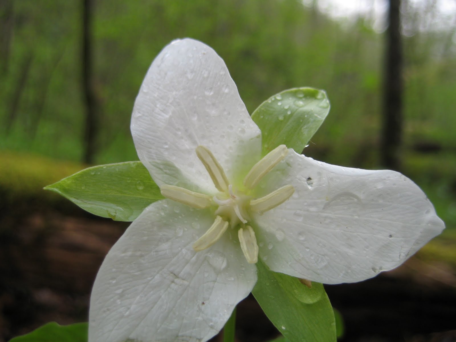
These wildflower photos have been taken over the past four or five years around on the Thompson Creek, Ripey, Rampart, and Sipsey River trails. The flowers are most beautiful in April, but can be found earlier and later if one looks carefully.